Busque também em nossas outras coleções:

Data da imagem:
Pauta
Agência
Fotógrafo
Estado
Cidade
Local
Tipo de licença
Orientação
Coleção

Total de Resultados: 40

Página 1 de 1

alb3887208 
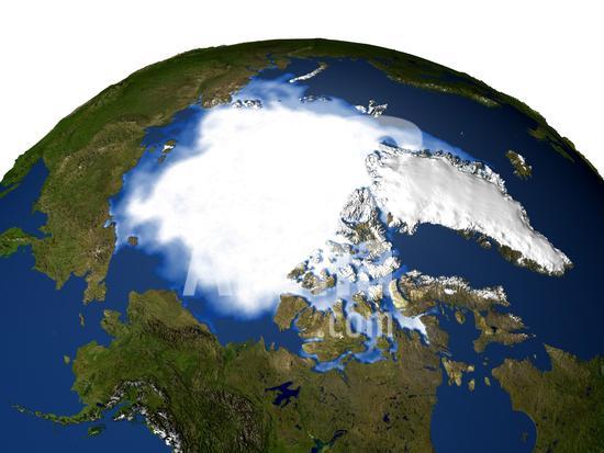
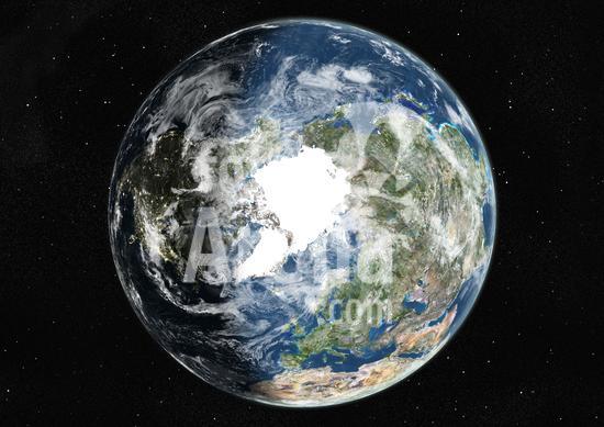
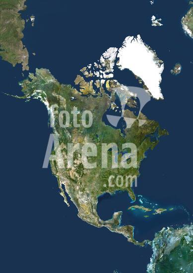
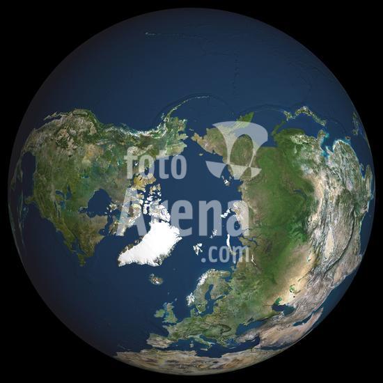
This is how North America may appear with average sea level about 100 meters (330 feet) above today's. Such a dramatic rise in sea level could occur if all of the Earth's glaciers were to melt.. In this image the Gulf of Mexico and Atlantic Ocean have inundated nearly all of southeastern United States including the entire state of Florida, nearly all of Louisiana, and significant portions of the other southeastern states and the District of Columbia. Major U.S. cities submerged include New York City, Boston and Houston, and on the west coast Los Angeles, San Francisco, and much of San Diego.. To the north the Hudson Bay has grown to claim much of the Canadian provinces of Ontario, Quebec, Manitoba and Nunavut. Further north Greenland's entire ice sheet, 110,000 years old and holding about 700,000 cubic miles of fresh water, has completely melted.. A likely cause of a catastrophic melting of the Earth ice stores would be a change in climate, a sudden rise in the global temperature accelerated by a runaway greenhouse effect. While the amount of water held by the Earth's glaciers can be calculated with some accuracy, the exact mechanism that would set those glaciers to melting, and how long it would take for them to melt, is poorly understood. Some models suggest that several millennia of higher temperatures would be required to melt all the world's glaciers, while others predict much faster processes on the scale of centuries, or even decades.
DC
917_05_020433 Satellite and computer generated image of the Arctic and Greenland.
DC
917_05_014556 Satellite thermographic image of the Atlantic Ocean showing coldest areas in Arctic, Antarctic and high Andes as bright orange. National Oceanic and Atmospheric Administration (NOAA). Science
DC
913_03_PO01299 Pechora River Delta, Russia, True Colour Satellite Image. True colour satellite image of the Pechora River Delta in Russia. The Pechora River flows into the Pechora Sea at Nosovaya. The sea at top is the Barents Sea. At the top of the image is part of Novaya Zemlya, an archipelago in the Arctic Ocean. Composite image using LANDSAT 5 data.
DC
913_03_PO01274 Mackenzie River Delta, Canada, True Colour Satellite Image. True colour satellite image of the Mackenzie River Delta. The Mackenzie River originates in Great Slave Lake, in the Northwest Territories (Canada), and flows north into the Arctic Ocean. Composite image using LANDSAT 7 data.
DC
913_03_PO01252 Great Bear Lake, Canada, True Colour Satellite Image. True colour satellite image of Great Bear Lake, in the Northwest Territories of Canada. This lake, which is the largest lake entirely within Canada, is situated on the Arctic Circle. It is covered with ice from late November to July. Composite image using LANDSAT 5 data.
DC
913_03_PO01096 Globe Centred On The North Pole, True Colour Satellite Image. True colour satellite image of the Earth centred on the North Pole with cloud coverage, at the equinox at 12 p.m GMT. This image in orthographic projection was compiled from data acquired by LANDSAT 5 & 7 satellites.
DC
913_03_PO01095 Globe Centred On The North Pole, True Colour Satellite Image. True colour satellite image of the Earth centred on the North Pole, at the equinox at 12 p.m GMT. This image in orthographic projection was compiled from data acquired by LANDSAT 5 & 7 satellites.
DC
913_03_PO01094 Globe Centred On The North Pole, True Colour Satellite Image. True colour satellite image of the Earth centred on the North Pole with cloud coverage, at the equinox at 6 p.m GMT. This image in orthographic projection was compiled from data acquired by LANDSAT 5 & 7 satellites.
DC
913_03_PO01093 Globe Centred On The North Pole, True Colour Satellite Image. True colour satellite image of the Earth centred on the North Pole, at the equinox at 6 p.m GMT. This image in orthographic projection was compiled from data acquired by LANDSAT 5 & 7 satellites.
DC
913_03_PO01092 Globe Centred On The North Pole, True Colour Satellite Image. True colour satellite image of the Earth centred on the North Pole with cloud coverage, at the equinox at 12 a.m GMT. This image in orthographic projection was compiled from data acquired by LANDSAT 5 & 7 satellites.
DC
913_03_PO01091 Globe Centred On The North Pole, True Colour Satellite Image. True colour satellite image of the Earth centred on the North Pole, at the equinox at 12 a.m GMT. This image in orthographic projection was compiled from data acquired by LANDSAT 5 & 7 satellites.
DC
913_03_PO01090 Globe Centred On The North Pole, True Colour Satellite Image. True colour satellite image of the Earth centred on the North Pole with cloud coverage, at the equinox at 6 a.m GMT. This image in orthographic projection was compiled from data acquired by LANDSAT 5 & 7 satellites.
DC
913_03_PO01089 Globe Centred On The North Pole, True Colour Satellite Image. True colour satellite image of the Earth centred on the North Pole, at the equinox at 6 a.m GMT. This image in orthographic projection was compiled from data acquired by LANDSAT 5 & 7 satellites.
DC
913_03_PO01088 Globe Centred On The North Pole, True Colour Satellite Image. True colour satellite image of the Earth centred on the North Pole with cloud coverage, during winter solstice at 12 p.m GMT. This image in orthographic projection was compiled from data acquired by LANDSAT 5 & 7 satellites.
DC
913_03_PO01087 Globe Centred On The North Pole, True Colour Satellite Image. True colour satellite image of the Earth centred on the North Pole, during winter solstice at 12 p.m GMT. This image in orthographic projection was compiled from data acquired by LANDSAT 5 & 7 satellites.
DC
913_03_PO01086 Globe Centred On The North Pole, True Colour Satellite Image. True colour satellite image of the Earth centred on the North Pole with cloud coverage, during winter solstice at 6 p.m GMT. This image in orthographic projection was compiled from data acquired by LANDSAT 5 & 7 satellites.
DC
913_03_PO01085 Globe Centred On The North Pole, True Colour Satellite Image. True colour satellite image of the Earth centred on the North Pole, during winter solstice at 6 p.m GMT. This image in orthographic projection was compiled from data acquired by LANDSAT 5 & 7 satellites.
DC
913_03_PO01084 Globe Centred On The North Pole, True Colour Satellite Image. True colour satellite image of the Earth centred on the North Pole with cloud coverage, during winter solstice at 12 a.m GMT. This image in orthographic projection was compiled from data acquired by LANDSAT 5 & 7 satellites.
DC
913_03_PO01083 Globe Centred On The North Pole, True Colour Satellite Image. True colour satellite image of the Earth centred on the North Pole, during winter solstice at 12 a.m GMT. This image in orthographic projection was compiled from data acquired by LANDSAT 5 & 7 satellites.
DC
913_03_PO01082 Globe Centred On The North Pole, True Colour Satellite Image. True colour satellite image of the Earth centred on the North Pole with cloud coverage, during winter solstice at 6 a.m GMT. This image in orthographic projection was compiled from data acquired by LANDSAT 5 & 7 satellites.
DC
913_03_PO01081 Globe Centred On The North Pole, True Colour Satellite Image. True colour satellite image of the Earth centred on the North Pole, during winter solstice at 6 a.m GMT. This image in orthographic projection was compiled from data acquired by LANDSAT 5 & 7 satellites.
DC
913_03_PO01080 Globe Centred On The North Pole, True Colour Satellite Image. True colour satellite image of the Earth centred on the North Pole with cloud coverage, during summer solstice at 12 p.m GMT. This image in orthographic projection was compiled from data acquired by LANDSAT 5 & 7 satellites.
DC
913_03_PO01079 Globe Centred On The North Pole, True Colour Satellite Image. True colour satellite image of the Earth centred on the North Pole, during summer solstice at 12 p.m GMT. This image in orthographic projection was compiled from data acquired by LANDSAT 5 & 7 satellites.
DC
913_03_PO01078 Globe Centred On The North Pole, True Colour Satellite Image. True colour satellite image of the Earth centred on the North Pole with cloud coverage, during summer solstice at 6 p.m GMT. This image in orthographic projection was compiled from data acquired by LANDSAT 5 & 7 satellites.
DC
913_03_PO01077 Globe Centred On The North Pole, True Colour Satellite Image. True colour satellite image of the Earth centred on the North Pole, during summer solstice at 6 p.m GMT. This image in orthographic projection was compiled from data acquired by LANDSAT 5 & 7 satellites.
DC
913_03_PO01076 Globe Centred On The North Pole, True Colour Satellite Image. True colour satellite image of the Earth centred on the North Pole with cloud coverage, during summer solstice at 12 a.m GMT. This image in orthographic projection was compiled from data acquired by LANDSAT 5 & 7 satellites.
DC
913_03_PO01075 Globe Centred On The North Pole, True Colour Satellite Image. True colour satellite image of the Earth centred on the North Pole, during summer solstice at 12 a.m GMT. This image in orthographic projection was compiled from data acquired by LANDSAT 5 & 7 satellites.
DC
913_03_PO01074 Globe Centred On The North Pole, True Colour Satellite Image. True colour satellite image of the Earth centred on the North Pole with cloud coverage, during summer solstice at 6 a.m GMT. This image in orthographic projection was compiled from data acquired by LANDSAT 5 & 7 satellites.
DC
913_03_PO01073 Globe Centred On The North Pole, True Colour Satellite Image. True colour satellite image of the Earth centred on the North Pole, during summer solstice at 6 a.m GMT. This image in orthographic projection was compiled from data acquired by LANDSAT 5 & 7 satellites.
DC
913_03_PO00332 Iceland, True Colour Satellite Image. Iceland, satellite image. This is a European country surrounded by the northern Atlantic Ocean. It lies just south of the Arctic Circle. Its capital, Reykjavik (in the bay at centre left), is the northernmost in the world. Iceland has a population of around 300,000 (2006). It is situation on a plate boundary and is thus very geologically active. This allows it to derive a large amount of its energy from geothermal sources, which it supplements with hydroelectric power. Together they provide around 99% of the country's energy. Composite image using data from LANDSAT 5 & 7 satellites.
DC
913_03_PO00318 King Oscar Fjord, Greenland, True Colour Satellite Image. King Oscar Fjord located in Greenland National Park. The pastel blue indicates that the water has turned into ice. Image taken on 21 June 1991 using LANDSAT data.
DC
913_03_PO00051 Iceland, True Colour Satellite Image. Iceland, true colour satellite image. This is a European country surrounded by the northern Atlantic Ocean. It lies just south of the Arctic Circle. Its capital, Reykjavik (in the bay at centre left), is the northernmost in the world. The image used data from LANDSAT 5 & 7 satellites.
DC
913_03_PO00019 North America, True Colour Satellite Image. North America. True colour satellite image centred on North America. The North Pole is at top centre. Water is blue, vegetation is green, arid areas are brown, and snow and ice are white. The terrain of North America is marked by mountain ranges on the western coast, deserts in the south-west, and large lakes in the north-east. The shades of green vary, showing central plains, marshes in the far north, swamps in the south-east and forests in the north-west. Surrounding North America (clockwise from top) is the Arctic Ocean, Greenland, part of the Atlantic Ocean, the Caribbean Sea and part of South America, and the Pacific Ocean. The image used data from LANDSAT 5 & 7 satellites.
DC
913_03_PO00016 Asia, True Colour Satellite Image. Asia. True colour satellite image centred on Asia, with nearly all of Africa (down left) and Europe (upper left) seen. This image shows the curvature of the Earth, with north-south lines converging towards top. The terrain of Asia varies from deserts (brown, central and southern Asia), to tropical rainforests (dark green, South-East Asia and the Malay Archipelago), to grasslands, forests and tundra (lighter green, northern Asia), and mountain ranges (centre). Also seen is the Arctic (top), Alaska (top right), and the Pacific Ocean (right) and Indian Ocean (lower left). The image used data from LANDSAT 5 & 7 satellites.
DC
913_03_PO00010 Globe North Pole, True Colour Satellite Image. Cloudless true colour satellite image of the Earth, centred on the Arctic or north polar region. The Arctic region consists of an ice-covered ocean which is almost wholly surrounded by large land masses. The image used data from LANDSAT 5 & 7 satellites. Print size 42x42cm.
DC
913_03_PO00006 Globe Asia, True Colour Satellite Image. Earth. True colour satellite image of the Earth, centred on Asia. The North Pole is at upper centre. Water is blue, vegetation is green, arid areas are brown, and snow and ice are white. Both land and ocean floor topography are shown. The terrain of Asia varies from deserts (brown, central and southern Asia), to tropical rainforests (dark green, South- East Asia), to plains, forests and tundra (lighter green, northern Asia), and mountain ranges (lower centre). Surrounding mainland Asia (clockwise from top) is the Arctic Ocean (with Greenland and North America beyond), the Pacific Ocean, the Malay Archipelago and northern Australia, the Indian Ocean, north-eastern Africa, and Europe. The picture is a composite created from thousands of separate images recorded by LANDSAT 5 & 7 satellites. Print size 42x42cm.
DC
913_03_PO00004 Globe North America, True Colour Satellite Image. Earth. True colour satellite image of the Earth, centred on North America. The North Pole is at upper centre. Water is blue, vegetation is green, arid areas are brown, and snow and ice are white. Both land and ocean floor topography are shown. The terrain of North America is marked by mountain ranges on the western coast, deserts in the south-west, and large lakes in the north-east. The shades of green vary, showing central plains, marshes in the far north, swamps in the south-east and forests in the north-west. Surrounding North America (clockwise from top) is the Arctic Ocean, Greenland, and the Atlantic Ocean (beyond which are Asia, Europe and Africa), South America and the Pacific Ocean. The image used data from LANDSAT 5 & 7 satellites. Print size 42x42cm.
DC
913_03_PO00001_b World With Arctic Ice Pack In Geographic Projection, True Colour Satellite Image. True colour cloudless satellite image of the whole Earth, with Arctiv pack ice, shown in geographic projection. This image was compiled from data acquired by LANDSAT 5 & 7 satellites.
DC
0185407 EARTH FROM SPACE: OZONE. /nAn image made by a Total Ozone Mapping Spectrometer (TOMS) on board a NASA satellite, 24 March 1997, showing the ozone over the Northern Hempisphere.
DC

Total de Resultados: 40

Página 1 de 1