Busque também em nossas outras coleções:

Tipo de arquivo:

Tipo do arquivo:

Orientação:

Total de Resultados: 139

Página 1 de 2

LLJ604171 Plan, elevations and sections of museum building on Kensington Gore Estate
DC
LIP1589067 The Bessemer Saloon Steamship. Illustration for The Illustrated London News, 14 December 1872.English School (19th Century)
DC
LIP1593972 Plan and Sections of the Great Metropolitan Sewage Drains, North and South of the Thames. Illustration for The Pictorial Times, 7 February 1846.English School (19th Century)
DC
STC169746 located on Fury Beach, North Somerset;
DC
LIP1106272 Plans and Sections of the Royal Treasuries at Mycenae. Illustration for The Illustrated London News, 7 April 1877.
DC
FAF3559591 A small domed, central plan building (baptistry?), in Rhodes
DC
ATH475171 Illustration in 'Essay on Colonization' by Carl Bernhard Wadström.
DC
BL3284730 No. 5. PLANS and SECTIONS of MONTAGU BASTION at GIBRALTAR[Gibraltar]: [producer not identified], [between 1774 and 1778.] Language: EnglishSource/Shelfmark: Maps K.Top.72.38.2.f.1.2.TAB
DC
TW1214709
DC
LIP1613666 Plans and Sections of the Turrets and Guns of HMS Thunderer. Illustration for The Illustrated London News, 20 April 1872.English School (19th Century)
DC
CH3526034 Petit Trianon, built between 1762 and 1768 during the reign of Louis XV, is a small château located on the grounds of the Palace of Versailles.
DC
UIG2601281
DC
BL3309529 No. 5. PLANS and SECTIONS of MONTAGU BASTION at GIBRALTAR.: as it was Executed and Finished the 7th: November 1774, under the Direction of W: Green Chief Engineer & Lt, Coll.[Gibraltar]: [producer not identified], [between 1774 and 1778.] Language: EnglishSource/Shelfmark: Maps K.Top.72.38.2.f.1.2.TAB
DC
LIP1602919 Sections of the Royal Sovereign and Royal Arthur. Illustration for The Illustrated London News, 7 March 1891.English School (19th Century)
DC
BL3284385 No. 5. PLANS and SECTIONS of MONTAGU BASTION at GIBRALTAR[Gibraltar]: [producer not identified], [between 1774 and 1778.] Language: EnglishSource/Shelfmark: Maps K.Top.72.38.2.f.1.2.TAB
DC
INC2969262
DC
TW1214712
DC
TW1214711
DC
TW1214713
DC
TW1214710
DC
TW1214714
DC
STC168915 means of egress from lower deck;
DC
FAF3557811 Artist: Bianchi, SalvatoreDate of Artwork: 1869-1874Location: Piazza dei Cinquecento, RomePhotographer: Alinari, Fratelli
DC
BL3308669 A collection of eighty views, maps, portraits and drawings illustrative of the Embassy sent to China under George, Earl of Macartney, in 1793; drawn chiefly by William Alexander, some by Sir John Barrow, Bart, some by Sir Henry Woodbine Parish, and one by William Gomm. Many of them are engraved in Sir George Staunton's Narrative of the Embassy, published in 1797.Author: Parish, William Henry / Illustrator: Parish, William Henry1793Source/Shelfmark: Maps 8 TAB.c.8.80.a.1 drawing: Indian ink; sheet 23.4 x 37.2 cm
DC
HRP2966543 Design for the Regalia strong room in the Wakefield Tower. Showing an elevation, section and details. The Crown Jewels have been displayed in various locations around the Tower of London, including in the Wakefield Tower between 1870 and 1967. In 1910-11 the original Victorian cage made by Messers Brown and Downing of Birmingham was replaced with this highly secure strong room. This drawing shows an elevation of one bay of the strong room, two sections through the structure and details of the bronze decorative ornament.
DC
MGS180336
DC
BL3297100 85 sheets of drawings of the site and sculptures at Amaravati and two notesIllustrator: Anon1816 - 1819Language: EnglishSource/Shelfmark: WD 1061, f.10
DC
ATH3081942 This flower, commonly known as the wood lily, is shown with leaves, two views of the calyx, two cross sections of the calyx, and a diagram or ground plan of the flower.
DC
BL3297637 Plans, Elevations, and Sections of Buildings executed in ... Norfolk, Suffolk, Yorkshire, Staffordshire, Warwickshire, Hertfordshire, et caetera.Author: Soane, Sir John / London, 1788Language: EnglishSource/Shelfmark: 56.i.8, plate 43
DC
BL3284164 R.U.S.I. MAPS. Vol. LXXVI (1-13). 57711 (1-4). Places in states North-East of New York.18th century. Circa 1750.Source/Shelfmark: Add. 57711.1 Amherst no. A 75. R.U.S.I. no. A 30.58. 1: 480. 'Scale to the plan 40 feet to an inch'. Scale bar of 200 feet (= 5 inches). Inset, elevation and sections of the proposed works. 1: 240. 'Scale . . . 20 feet to an inch'. Scale bar of 100 feet (= 5 inches). 265 x 445mm.
DC
ATH3081917 The flower, commonly known as yellow clintonia, is depicted with its long stem and leaves. There is a also a diagram or ground plan of the flower.
DC
BL3274682 Illustrator: Prinsep, James. Source/Shelfmark: WD 4277, Map and cross section of the drainage tunnel from the Machhodri tank to the river with elevation and cross section of the tunnelling process and drawings of the equipment used. Inscribed: 'Plan of the Mutsyoduree Tunnel. Proposed 30th April 1825. Sanctioned 2nd June 1825. Commenced masonry 1826. Completed 31 July 1827'. Pen and ink and water-colour.
DC
FAF3557864 Artist: Diotisalvi;Giovanni Pisano (1248 c.-1315)Date of Artwork: 1152Location: PisaPhotographer: Alinari, Fratelli
DC
XOS7300727
DC
ATH3081980 The central drawing depicts the plant with its leaves, stems, and flowers. There is also a detail of the flower with the number 3 beside it, a detail of the sepals with the pistil attached, two detials of the anthers, a diagram or ground-plan of the flower, and a detail of the flower bud with the petals encased in the sepals.
DC
ILN198859
DC
LLM8644775 Roman Temples, Plans, Sections, and Details. Illustration for Architecture, Sculpture, and the Industrial Arts among the Nations of Antiquity by E A Seemann (Arthur Ackermann, c 1880).
DC
FAF3559375 Artist: Guerrini, Giovanni;Romano, Mario;La Padula, Ernesto (1902-1968)Date of Artwork: 1938 -1943Location: RomePhotographer: Alinari, Fratelli
DC
FAF3558841 Artist: Buonarroti Michelangelo (1475-1564);Della Porta Giacomo;Rainaldi, GirolamoDate of Artwork: 1582-1605Location: Piazza del Campidoglio, RomePhotographer: Alinari, Fratelli
DC
STC171169
DC
STC255217 from 'Plans, Elevations and sections of Hothouses, Green-Houses an Aquarium and Conservatories...' by George Tod;
DC
ATH3081893 The sheet contains eleven botanical drawings of the flower commonly known as dragon's mouth. There are three drawings of the seed and roots, one of them labeled 'Bud for the coming spring.' There is a section of the flower, a diagram or ground plan of the flower, two sections detailing the top of the style with its helmet-shaped hinged anther, over a little shelf, the lower face of which is the stigma, a drawing of the ripe pod, a diagram labeled 'ripe pod,' another diagram labeled 'lip,' and a drawing of the flower still encased in its sepals.
DC
BL3290735 A collection of one hundred and ninety-five colored plans, elevations, and sections of the Pontifical Palace in the VaticanLanguage: ItalianSource/Shelfmark: 75.K.1-3 vol.3 no.69From a collection of one hundred and ninety-five colored plans, elevations, and sections of the Pontifical Palace in the Vatican, distinguishing all the portions allotted to the various departments and officers of the Papal court; drawn on a large scale, about the latter part of the 17th century, 1650-1700.
DC
BL3304958 Picture-map of central and eastern TibetIllustrator: Anon1844 - 1862Source/Shelfmark: Add.Or.3017 f.4Watercolour. Tibetan school.
DC
BL3304954 Picture-map of central and eastern TibetIllustrator: Anon1844 - 1862Source/Shelfmark: Add.Or.3017 f.1Watercolour. Tibetan school.
DC
BL3304959 Picture-map of central and eastern TibetIllustrator: Anon1844 - 1862Source/Shelfmark: Add.Or.3017 f.5Watercolour. Tibetan school.
DC
BL3304957 Picture-map of central and eastern TibetIllustrator: Anon1844 - 1862Source/Shelfmark: Add.Or.3017 f.3Watercolour. Tibetan school.
DC
BL3304961 Picture-map of central and eastern TibetIllustrator: Anon1844 - 1862Source/Shelfmark: Add.Or.3017 f.6Watercolour. Tibetan school.
DC
XLE3774346 Seating plan of the Philadelphia Orchestra instrument sections,-conductor Eugene Ormandy-violin section, wind section etc-1949
DC
BL3304955 Picture-map of central and eastern TibetIllustrator: Anon1844 - 1862Source/Shelfmark: Add.Or.3017 f.2Watercolour. Tibetan school.
DC
STC420683
DC
NYH1079253 one of four separate photographs showing sections, recto and verso/ four insets showing Manhattan voting wards and senate districts, congressional districts, school districts, and justices districts.unidentified
DC
NYH1079278 Map of the City of New York; downtown area; inset: "12th Ward. City of New York" (above 40th Street); "for D.T. Valentine's Manual 1850"Valentine, David T.
DC
BL3900090
DC
NYH1079252 one of four separate photographs showing sections, recto and verso / four insets showing Manhattan voting wards and senate districts, congressional districts, school districts, and justices districts.unidentified
DC
BMM7315308 Creator: Marc Isambard BrunelAutograph sketch-plan by Brunel showing two sections of the proposed cylindrical tunnel, one empty, the other with a coach passing through with wounded veteran and prosperous gentleman across the divide, dated "10 April 1818", and captioned "Two Tunnels of 17 f[eet]. D[iameter] each would be preferable to one of 24 feet".
DC
LLP979822 Plan of Brighton, divided into quarter mile sections, showing a street layout and the London Brighton and South Coast Railway.
DC
XIR161390 Eight-foot telescope constructed by Dom Noel following the instructions of the duc de Chaulnes, presented to the king (Louis XV) on December 10 1756. Le Pere (Father) Noel, of the Congregation of Saint-Maur
DC
BL3309956 Fort William and Mary on Piscataqua River1705Language: EnglishSource/Shelfmark: Maps K.Top.120.28.a
DC
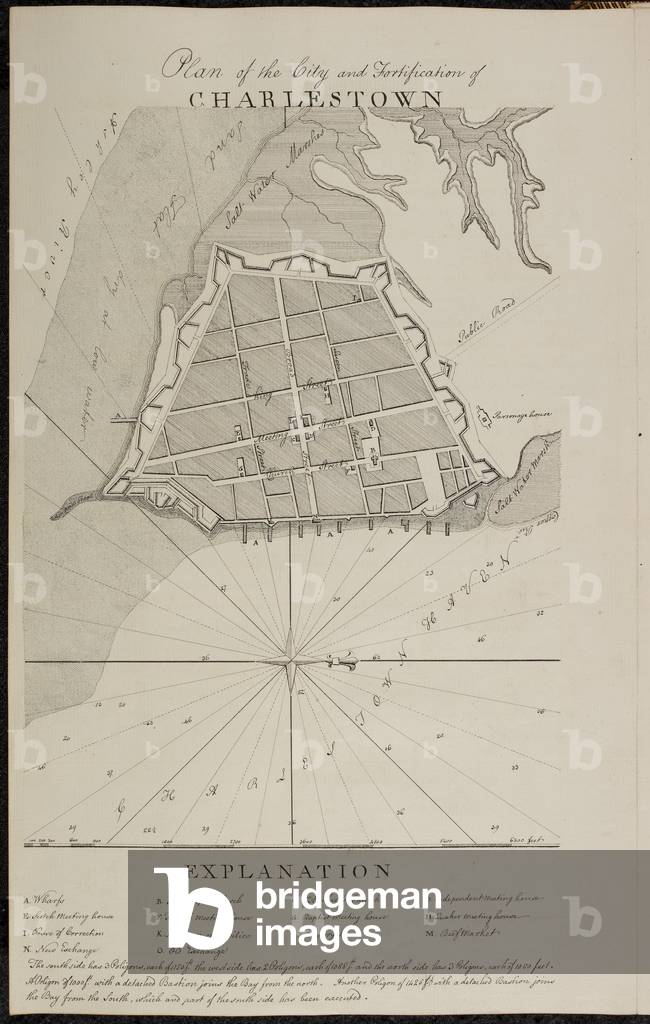
BL3286340 Report of the General Survey in the Southern District of North America: delivered to the Board of Trade and Plantations in three seperate returns and sections, entering with the history of South Carolina and Georgia, then proceeding to the history of East Florida', &c.1773-1774? Language: EnglishSource/Shelfmark: Kings 210, f.4
DC
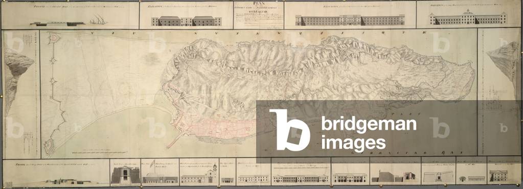
BL3299932 A colored "plan of the isthmus, city, and fortifications of Gibraltar, shewing elevations and sections of the principal public buildings, profiles through the two extremities of the rock, and forts built by the Spaniards; also the soundings and particular heights of the hill laid down on the plan, with several additional designs for better defending and securing the place;" 1751Language: EnglishSource/Shelfmark: Maps K.Top.72.36
DC
BL3308654 A collection of eighty views, maps, portraits and drawings illustrative of the Embassy sent to China under George, Earl of Macartney, in 1793; drawn chiefly by William Alexander, some by Sir John Barrow, Bart, some by Sir Henry Woodbine Parish, and one by William Gomm. Many of them are engraved in Sir George Staunton's Narrative of the Embassy, published in 1797.Author: Parish, William Henry / Illustrator: Parish, William Henry1793Source/Shelfmark: Maps 8 TAB.c.8.75.a. (No.5 E.E.E.E. - 1. & 43 in pencil).1 drawing: Ink and wash; sheet 23.2 x 37.2 cm; Scale 1: 240. 20 feet to an inch.
DC
BL3284155 Plan of Fort Ontario and its environs . . . survey'd by Thomas Sowers Enginr, drawn by William Brasier July 22 1760'.Illustrator: Sowers, ThomasSurvey'd by Thomas Sowers Enginr, drawn by William Brasier July 22 1760.Source/Shelfmark: Add. 57708.6 Amherst no. C 43. R.U.S.I. no. A 30.55. 1: 4800. 'Scale for the general plan 400 feet to an inch'. Scale bars of 2000 feet (= 5 inches) and 900 yards (= 6.75 inches). Inset, sections and plan of fort: 1: 480; 'scale for the sections 40 feet to an inch'; scale bar of 150 feet (= 3.75 inches).525 x 890mm.
DC
BL7371592 1:480. 'Scale of 40 feet to an inch'. Scale bar of 360 feet (= 9 inches). There are five elevations and a large-scale plan of the location, with a key and notes signed by Loxley on an separate sheet (f. 9*). '229' in ink on verso; also 'A 90', but this may not be an Amherst no3 sheets, joined, 1230 x 380mm.
DC
BL3284174 R.U.S.I. MAPS. Vol. LXXVI (1-13). 57711 (1-4). Places in states North-East of New York.18th century. 1764Source/Shelfmark: Add. 57711.11 Amherst no. A 47. R.U.S.I. no. A 30.70. 1: 1800. 'Scale of 150 feet to one inch'. Scale bar of 300 feet (= 2 inches). Inset, sections of the fort. 1: 180. 'Scale for all the sections 15 feet to an inch'. Scale bar of 40 feet (= 2 inches).560 x 445mm.
DC
BL3305077 A colored "plan of Fort Ontario [and its environs], with the several alterations and additional works proposed by the chief Engineer;" drawn about 1760, by Wm. Brasier, on a scale of 200 feet to an inch; with profils and sections on a scale of 20 feet to an inch. c.1760Source/Shelfmark: Maps.K.Top.121.87
DC
CH651983 Designs for a Neo-Classical House for Lord Charleville: Three Sections (nos.9-11). James Byres (1734-1817). Pencil, pen and grey ink and watercolour. Signed and dated 1789. 62.2 x 99.6cm. Part of a group of architectural drawings commissioned by Lord Charleville, when in Rome on the Grand Tour in 1789.
DC
STC255219 from 'Plans, Elevations and sections of Hothouses, Green-Houses an Aquarium and Conservatories...' by George Tod;
DC
STC255214 from 'Plans, Elevations and sections of Hothouses, Green-Houses an Aquarium and Conservatories...' by George Tod;
DC
STC255212 from 'Plans, Elevations and sections of Hothouses, Green-Houses an Aquarium and Conservatories...' by George Tod;
DC
STC255213 from 'Plans, Elevations and sections of Hothouses, Green-Houses an Aquarium and Conservatories...' by George Tod;
DC
CH659217
DC
STC255290 from 'Plans, Elevations and sections of Hothouses, Green-Houses an Aquarium and Conservatories...' by George Tod;
DC
STC255287 from 'Plans, Elevations and sections of Hothouses, Green-Houses an Aquarium and Conservatories...' by George Tod;
DC
STC255220 from 'Plans, Elevations and sections of Hothouses, Green-Houses an Aquarium and Conservatories...' by George Tod; executed for John Walter;
DC
STC255286 from 'Plans, Elevations and sections of Hothouses, Green-Houses an Aquarium and Conservatories...' by George Tod;
DC
BL3284175 R.U.S.I. MAPS. Vol. LXXVI (1-13). 57711 (1-4). Places in states North-East of New York.18th century. Source/Shelfmark: Add. 57711.12 Amherst no. A 47. R.U.S.I. no. A 30.69. 1: 480. 'Scale for the plan 40 feet to an inch'. Scale bar of 240 feet (= 6 inches). Inset, sections of the fort. 1: 240. 'Scale for the section 20 feet to an inch'. Scale bar of 120 feets [ sic ] (= 6 inches).425 x 530mm.
DC
BL3725694
DC
STC255221 from 'Plans, Elevations and Sections of Hot-Houses, Green-Houses an Aquarium and Conservatories...' by George Tod; executed for Champion Dymoke;
DC
BL3280432 A series of plans, elevations, and sections, in Inca. 1714-1720Language: EnglishSource/Shelfmark: Maps.K.Top.23.11.h,An outline ground plan, with variations, and inscribed in Hawksmoor's hand, 1714, this plan correct; on a scale of 10 feet to an inch: 46 x 30 cm.Image taken from A series of plans, elevations, and sections, in Indian ink, of Christ Church, Spital Fields, built by Nicholas Hawksmoor; some of them in the architect's own hand..Originally published/produced in ca. 1714-1720.
DC
STC255216 from 'Plans, Elevations and sections of Hothouses, Green-Houses an Aquarium and Conservatories...' by George Tod; executed for Lady Jennings Clarke at holy Grove;
DC
STC255218 from 'Plans, Elevations and sections of Hothouses, Green-Houses an Aquarium and Conservatories...' by George Tod; executed for Lord Heathfield at Nutwell court, Devon;
DC
BL5619474 Insurance Plan of the City of Liverpool. [By] C.E. Goad. (Vol. I. Scale, 40 ft. = 1 inch. Vol. II. [On various scales.] Vol. III. Scale, 80 ft. = 1 inch, Vol. IV. Scale, 40 feet = 1 inch). Insurance mapping was occasionally supplemented by cross-sections of buildings which presented particular fire hazards. This detail shows the Petroleum Storage Wharf, c.1860, watercolour.
DC
CHT617394 Together with the map of Sebastian Münster and the 'Plan de la Gouache', this is one of the oldest plans of Paris. The original map was woven as a tapestry c. 1571 for Cardinal Charles de Bourbon (1523-90). In 1571 he was made Lieutenant-General of Paris and Ile de France and his heraldic arms are displayed here. Later the tapestry passed to the Guise family and was kept at the Hôtel de Clisson. The tapestry disappeared during the French Revolution but a copy had been made for the French antiquary, François de Gaignières (1642-1715) écuyer (equerry) to Louis Joseph, duke of Guise (1650-71). This map shows Paris after the beginning of the dismantling in 1533 (on the orders of François Premier) of the inner Right Bank Enceinte (city wall) of Philippe II Auguste but the sections near the Louvre and in the 3rd and 4th Arrondissements are clearly visible on the map.
DC
RBG9046277 Illustration from Sir William Chambers 1763 publication, Plans, elevations, sections, and perspective views of the gardens and buildings at Kew in Surry
DC
CHT163104 Together with the map of Sebastian Münster and the 'Plan de la Gouache', this is one of the oldest plans of Paris. The original map was woven as a tapestry c.1571 for Cardinal Charles de Bourbon (1523-90). In 1571 he was made Lieutenant-General of Paris and Ile de France and his heraldic arms are displayed here. Later the tapestry passed to the Guise family and was kept at the Hôtel de Clisson. The tapestry disappeared during the French Revolution but a copy had been made for the French antiquary, François de Gaignières (1642-1715) écuyer (equerry) to Louis Joseph, duke of Guise (1650-71). This map shows Paris after the beginning of the dismantling in 1533 (on the orders of François Premier) of the inner Right Bank Enceinte (city wall) of Philippe II Auguste but the sections near the Louvre and in the 3rd and 4th Arrondissements are clearly visible on the map.
DC
BL3279463 [Bowles's new plan of London, Westminster and SoutLondon: Bowles & Carver, 1806Language: EnglishSource/Shelfmark: Maps.3480.(255),Section of a map of London.Image taken from [Bowles's new plan of London, Westminster and Southwark, with their environs to the extent of three miles round St. Paul's Scale of one mile[ = 160 mm]]..Originally published/produced in London: Bowles & Carver, 1806.
DC
RBG9034768 Plan of the Temperate House, Royal Botanic Gardens, Kew, 1800s. Sections full size of rolled iron rafters to upper roof of centre building.
DC
BL3308679 A collection of eighty views, maps, portraits and drawings illustrative of the Embassy sent to China under George, Earl of Macartney, in 1793; drawn chiefly by William Alexander, some by Sir John Barrow, Bart, some by Sir Henry Woodbine Parish, and one by William Gomm. Many of them are engraved in Sir George Staunton's Narrative of the Embassy, published in 1797.1793Source/Shelfmark: Maps 8 TAB.c.8.87.a. 1 drawing: Indian ink; sheet 46.7 x 37 cm
DC
BL3308656 A collection of eighty views, maps, portraits and drawings illustrative of the Embassy sent to China under George, Earl of Macartney, in 1793; drawn chiefly by William Alexander, some by Sir John Barrow, Bart, some by Sir Henry Woodbine Parish, and one by William Gomm. Many of them are engraved in Sir George Staunton's Narrative of the Embassy, published in 1797. Engraved in Staunton, Atlas No. 23. Author: Parish, William Henry / Illustrator: Parish, William Henry1793Source/Shelfmark: Maps 8 TAB.c.8.75.b.1 drawing: Ink and wash; sheet 23 x 37 cm; Scale 1: 240. 20 feet to an inch.
DC
BL2656941 William III (Dutch: Willem III; 4 November 1650 – 8 March 1702) was sovereign Prince of Orange from birth, Stadtholder of Holland, Zeeland, Utrecht, Gelderland, and Overijssel in the Dutch Republic from 1672, and King of England, Ireland, and Scotland from 1689 until his death. It is a coincidence that his regnal number (III) was the same for both Orange and England. As King of Scotland, he is known as William II. He is informally and affectionately known by sections of the population in Northern Ireland and Scotland as "King Billy".
DC
BL3308681 A collection of eighty views, maps, portraits and drawings illustrative of the Embassy sent to China under George, Earl of Macartney, in 1793; drawn chiefly by William Alexander, some by Sir John Barrow, Bart, some by Sir Henry Woodbine Parish, and one by William Gomm. Many of them are engraved in Sir George Staunton's Narrative of the Embassy, published in 1797.1793Source/Shelfmark: Maps 8 TAB.c.8.87.c.1 drawing: Indian ink; sheet 46.5 x 37 cm.
DC
KOX5888774 William Butterfield, noted Gothic Revival architect, and closely associated with the Oxford Religious Movement (or Tractarian Movement). He is renowned for his use of polychromy. Butterfield’s design of Keble College was radically different from the existing traditional University architecture, featuring geometric patterns in varying colours of brick.This architectural drawing shows elevations, sections, and plan views for the proposed gateway to the College.
DC
CH986351 Castle Howard in Yorkshire, from 'Vitruvius Britannicus', or 'The British Architect, containing the Plans, Elevations, and Sections of the regular buildings both publick and private, in Great Britain' by Colin Campbell (1676-1729) & Others. Engraved by Hendrick Hulsberg (1700-1730). Engraving. Published 1715-1771.
DC
BL3295481 A colored chart of the upper part of Lake Erie; on a scale of 900 yards to an inch: with a Language: EnglishSource/Shelfmark: Maps K.Top.119.17A colored chart of the upper part of Lake Erie; on a scale of 900 yards to an inch: with a "plan of Fort Erie, built under the direction of John Montresor, engineer, 1764;" on a scale of 200 feet to an inch; the sections on a scale of 15 feet to an inch; drawn by Francis Pfister.
DC
BL3308680 A collection of eighty views, maps, portraits and drawings illustrative of the Embassy sent to China under George, Earl of Macartney, in 1793; drawn chiefly by William Alexander, some by Sir John Barrow, Bart, some by Sir Henry Woodbine Parish, and one by William Gomm. Many of them are engraved in Sir George Staunton's Narrative of the Embassy, published in 1797.1793Source/Shelfmark: Maps 8 TAB.c.8.87.b.1 drawing: Indian ink; sheet 46.5 x 37 cm
DC
FLO4591504 Plan of a coal mine and mode of ventilation, 19th century. Geological sections of metallic veins, chalk, basalt, and limestone. Copperplate engraving by Wilson Lowry from Abraham Rees' Cyclopedia or Universal Dictionary of Arts, Sciences and Literature, Longman, Hurst, Rees, Orme and Brown, London, 1818.
DC
KOX5888808 William Butterfield, noted Gothic Revival architect, and closely associated with the Oxford Religious Movement (or Tractarian Movement). He is renowned for his use of polychromy. Butterfield’s design of Keble College was radically different from the existing traditional University architecture, featuring geometric patterns in varying colours of brick.This architectural drawing shows plans for each floor of Block 3, sections through various points along the building, and elevations from the quad and the new road. These buildings now form part of North side of Liddon quad.
DC
CH985788 Details of the Arches in the Sala de los Abencerages. A plate from the book 'Plans, elevations, sections and details of the Alhambra'. Owen Jones (1809-1874) after Emile Goury (fl.1839-1844). Chromolithograph. Engraved in 1839.
DC
MAN5980408 Architectural drawings of a chancel arch. There are measurements recorded across the design with cross sections on the right and on the right and left of the lower section. There are inscriptons either side of a cross above the key stone of the arch.
DC

Total de Resultados: 139

Página 1 de 2