Busque também em nossas outras coleções:

Data da imagem:
Pauta
ver mais opções...
Agência
ver mais opções...
Fotógrafo
ver mais opções...
Pais
ver mais opções...
Estado
ver mais opções...
Cidade
ver mais opções...
Local
ver mais opções...
Editorias
ver mais opções...
Tipo de licença
Orientação
Coleção
ver mais opções...

Total de Resultados: 10.000

Página 1 de 100

990_05_9-US-LA_13HR Louisiana: March 6, 1920 Louisiana French (Cajuns) gathering moss in the bayous of Louisiana. It is dried and used as a substitute for hair which is used for stuffing upholstery and automobile cushions.
DC
1903463 Em destaque o personagem Roccket do Filme Guardiôes da Galáxia "Guardian of the Galaxy") - Edição limitada da Coca-Cola sem açúcar estampada pelos ?Vingadores: Ultimato?, (Avengers End Game) da Marvel Studios, lançada em 2019.
DC
1903431 Em destaque o personagem Roccket do Filme Guardiôes da Galáxia "Guardian of the Galaxy") - Edição limitada da Coca-Cola sem açúcar estampada pelos ?Vingadores: Ultimato?, (Avengers End Game) da Marvel Studios, lançada em 2019.
DC
412-44706 Portrait enthusiastic senior woman holding bag of fresh vegetables on balcony
RF
902_05_12529286highres Vologases III superintends the collection of the Pahlavi Avesta, 160 AD. Vologases III, Parthian Prince who claimed the throne of the Parthian Empire. From Hutchinson's History of the Nations, published 1915
DC
902_05_12529463highres The Pepys Library, Magdalene College, Cambridge, England. From Old England: A Pictorial Museum, published 1847.
DC
902_05_12529153highres The harp accompanied by other instruments, after a Cotton MS. The Cotton or Cottonian library is a collection of manuscripts once owned by Sir Robert Bruce Cotton (1571-1631), an antiquarian and bibliophile. From Old England: A Pictorial Museum, published 1847.
DC
902_05_12516123highres Postcard 1900.Victorian/Edwardian.Social History.The firm of Misch & Stock began their postcard production in 1903. Two years later the name was changed to Misch & Co., when Stock retired. As fine art publishers, the quality of production was absolutely outstanding and well suited to the reproduction of paintings on postcards. Sorrow - Greuze, the Wallce collection London
DC
902_05_12515960highres Postcard 1900.Victorian/Edwardian.Social History.The firm of Misch & Stock began their postcard production in 1903. Two years later the name was changed to Misch & Co., when Stock retired. As fine art publishers, the quality of production was absolutely outstanding and well suited to the reproduction of paintings on postcards. Fidelity- after Greuze from the Wallace Collection London
DC
902_05_12516056highres Magic lantern slide circa 1900.Victorian/Edwardian.Social History.No. 15. ?Drawing Water.?Since the subjugation of Algiers the Ercnch have conferred various benefits on the colonists and natives, not the least that of digging Artesian-wells and generally giving a supply of good pure water. Here we see one of the many sources of supply of fresh wrater which, free to all alike, may be found in considerable number distributed over various parts of the town. This picture, in which the posing and tout ensemble are somewhat artistically rendered, is very suggestive of the Eastern custom of drawing water, though not from the well in the ordinary sense. The ?water is generally drawn into and carried about in copper vessels, one of which is receiving water in the view before us [B]. It is the orthodox shape, and is in use all over Algiers.
DC
902_05_12523024highres Gleason's Pictorial Drawing Room Companion, 1852 etching or wood engraving. Children of Trinity church,Brooklyn,making their Easter Offerins to the church
DC
902_05_12529155highres A medieval wine press, after a Cotton MS. The Cotton or Cottonian library is a collection of manuscripts once owned by Sir Robert Bruce Cotton (1571-1631), an antiquarian and bibliophile. From Old England: A Pictorial Museum, published 1847.From Old England: A Pictorial Museum, published 1847.
DC
902_05_12519062highres A magic lantern slide circa 1900. Religious slides . The chained bible. Although called the Great Bible because of its large size, it is known by several other names as well: the Cromwell Bible, since Thomas Cromwell directed its publication; Whitchurch's Bible after its first English printer; the Chained Bible, since it was chained to prevent removal from the church. It has less accurately been termed Cranmer's Bible, since although Thomas Cranmer was not responsible for the translation, a preface by him appeared in the second edition. From the Bible Collection of the University of St Andrews. Genre Dates (Provenance) -- Scotland -- St. Andrews -- 17th century. Stained calf bindings (Bindings) -- Scotland -- St. Andrews -- 16th century. Chained bindings (Binding) -- Scotland -- St. Andrews -- 16th century.
DC
902_05_12529151highres A dinner party, after a Cotton MS. The Cotton or Cottonian library is a collection of manuscripts once owned by Sir Robert Bruce Cotton (1571-1631), an antiquarian and bibliophile. From Old England: A Pictorial Museum, published 1847.
DC
913_03_PO07591 Color satellite image of El Paso?Juarez, a binational metropolitan area on the border between the United States and Mexico. El Paso, Texas, US is at north and Ciudad Juarez, Mexico is at south. Image collected on January 29, 2018 by Sentinel-2 satellites.
DC
913_03_PO07590 Color satellite image of El Paso?Juarez, a binational metropolitan area on the border between the United States and Mexico. El Paso, Texas, US is at north and Ciudad Juarez, Mexico is at south. Image collected on January 29, 2018 by Sentinel-2 satellites.
DC
913_03_PO07583 Color satellite image of Cape Canaveral, Florida, United States. Cape Canaveral Air Force Station is southeast of NASA's Kennedy Space Center on adjacent Merritt Island, with the two linked by bridges and causeways. Image collected on January 24, 2018 by Sentinel-2 satellites.
DC
71096_rf_38_holographic_matrix_universe_179a1h The Universe Is An Alien Computer Holographic Matrix Program.
DC
913_03_PO07684 Color satellite image of Volcanoes on Kamchatka Peninsula, Russia. Klyuchevskaya, to the right, the tallest and most active volcano on the peninsula is emitting a small plume of gas, steam, and ash. Strecthing along the northwest rim of the Pacific Ring of Fire, Kamchatka is one of the most volcanically active regions in the world. Image collected on January 10, 2018.
DC
913_03_PO07683 Color satellite image of Volcanoes on Kamchatka Peninsula, Russia. Klyuchevskaya, to the right, the tallest and most active volcano on the peninsula is emitting a small plume of gas, steam, and ash. Strecthing along the northwest rim of the Pacific Ring of Fire, Kamchatka is one of the most volcanically active regions in the world. Image collected on January 10, 2018.
DC
913_03_PO07600 Color satellite image of Minneapolis and Saint Paul, Minnesota, United States. The Twin Cities metropolitan area consists of Minneapolis, its neighbor Saint Paul, and suburbs. Image collected on November 18, 2017 by Sentinel-2 satellites.
DC
913_03_PO07599 Color satellite image of Minneapolis and Saint Paul, Minnesota, United States. The Twin Cities metropolitan area consists of Minneapolis, its neighbor Saint Paul, and suburbs. Image collected on November 18, 2017 by Sentinel-2 satellites.
DC
913_03_PO07598 Color satellite image of Minneapolis, Minnesota, United States. The Mississippi River flows through the city. Minneapolis?Saint Paul International Airport is at south. Image collected on November 18, 2017 by Sentinel-2 satellites.
DC
913_03_PO07597 Color satellite image of Minneapolis, Minnesota, United States. The Mississippi River flows through the city. Image collected on November 18, 2017 by Sentinel-2 satellites.
DC
913_03_PO07420 Color satellite image of Pyongyang, capital city of North Korea. It is located on the Taedong River. Image collected on November 02, 2017 by Sentinel-2 satellites.
DC
913_03_PO07382 Color satellite image of Guangzhou to Hong Kong, China. This region is called the Pearl River Delta. Image collected on November 01, 2017 by Sentinel-2 satellites.
DC
913_03_PO07375 Color satellite image of Shenzhen, China. It forms part of the Pearl River Delta megalopolis. Image collected on November 01, 2017 by Sentinel-2 satellites.
DC
913_03_PO07374 Color satellite image of Shenzhen, China. It forms part of the Pearl River Delta megalopolis. Image collected on November 01, 2017 by Sentinel-2 satellites.
DC
913_03_PO07367 Color satellite image of Macau, China. The city is located on the western side of the Pearl River estuary. Image collected on November 01, 2017 by Sentinel-2 satellites.
DC
913_03_PO07366 Color satellite image of Macau, China. The city is located on the western side of the Pearl River estuary. Image collected on November 01, 2017 by Sentinel-2 satellites.
DC
913_03_PO07365 Color satellite image of Hong Kong, China. The city is located on the eastern side of the Pearl River estuary. Image collected on November 01, 2017 by Sentinel-2 satellites.
DC
913_03_PO07363 Color satellite image of Guangzhou and Foshan, China. Both cities are part of the Pearl River Delta Metropolitan Region. Image collected on November 01, 2017 by Sentinel-2 satellites.
DC
913_03_PO07437 Color satellite image of Hanoi, capital city of Vietnam. It lies on the eastern bank of the Red River. Image collected on October 31, 2017 by Sentinel-2 satellites.
DC
913_03_PO07341 Color satellite image of Omdurman, Sudan. The city lies on the western banks of the River Nile, opposite the capital Khartoum. Image collected on October 25, 2017 by Sentinel-2 satellites.
DC
913_03_PO07340 Color satellite image of Khartoum, capital city of Sudan. It is located at the confluence of the White Nile to the west and the Blue Nile to the east. Image collected on October 25, 2017 by Sentinel-2 satellites.
DC
913_03_PO07560 Color satellite image of Staten Island, New York City, New York State, United States. Staten Island is one borough of New York City. It is separated from the rest of New York by New York Bay. Image collected on October 20, 2017 by Sentinel-2 satellites.
DC
913_03_PO07559 Color satellite image of the Bronx, New York City, New York State, United States. The Bronx is one borough of New York City. It lies north and east of Manhattan, across the Harlem River. Image collected on October 20, 2017 by Sentinel-2 satellites.
DC
913_03_PO07557 Color satellite image of Brooklyn, New York City, New York State, United States. Brooklyn is one borough of New York City. It lies at the southwestern end of Long Island. Image collected on October 20, 2017 by Sentinel-2 satellites.
DC
913_03_PO07556 Color satellite image of Manhattan, New York City, New York State, United States. Manhattan is one borough of New York City. It is bound by Hudson River to the west, Harlem River to the north, and East River to the east. Central Park is in the center. Image collected on October 20, 2017 by Sentinel-2 satellites.
DC
913_03_PO07507 Color satellite image of Beirut, capital city of Lebanon, with Beirut?Rafic Hariri International Airport in the south. Image collected on October 18, 2017 by Sentinel-2 satellites.
DC
913_03_PO07501 Color satellite image of the Gaza Strip, a self-governing Palestinian territory. Image collected on October 18, 2017 by Sentinel-2 satellites.
DC
913_03_PO07500 Color satellite image of Gaza, a Palestinian city in the Gaza Strip. Image collected on October 18, 2017 by Sentinel-2 satellites.
DC
913_03_PO07511 Color satellite image of Doha, capital city of Qatar, with Hamad International Airport to the right. Image collected on October 17, 2017 by Sentinel-2 satellites.
DC
913_03_PO07503 Color satellite image of Baghdad, capital city of Iraq, located along the Tigris River. Image collected on October 16, 2017 by Sentinel-2 satellites.
DC
hx04801 Man carrying branches on sunny mountain, Supi Bageshwar, Uttarakhand, Indian Himalayan Foothills
RF
913_03_PO07532 Color satellite image of Chicago, Illinois, United States. The city is located at the south western tip of Lake Michigan. Image collected on October 08, 2017 by Sentinel-2 satellites.
DC
913_03_PO07531 Color satellite image of Chicago, Illinois, United States. The city is located at the south western tip of Lake Michigan. Chicago O'Hare International Airport is at upper left. Image collected on October 08, 2017 by Sentinel-2 satellites.
DC
913_03_PO07570 Color satellite image of Nice, France. Nice Cote d'Azur Airport is located on the coast. Image collected on October 07, 2017 by Sentinel-2 satellites.
DC
913_03_PO07567 Color satellite image from Cannes to Nice, France, on the French Riviera. Image collected on October 07, 2017 by Sentinel-2 satellites.
DC
913_03_PO07391 Color satellite image of South Delhi, an administrative district of the National Capital Territory of Delhi in India. Image collected on October 07, 2017 by Sentinel-2 satellites.
DC
913_03_PO07390 Color satellite image of South West Delhi, an administrative district of the National Capital Territory of Delhi in India. Indira Gandhi International Airport lies to the south. Image collected on October 07, 2017 by Sentinel-2 satellites.
DC
913_03_PO07389 Color satellite image of West Delhi, an administrative district of the National Capital Territory of Delhi in India. Image collected on October 07, 2017 by Sentinel-2 satellites.
DC
913_03_PO07388 Color satellite image of North Delhi, an administrative district of the National Capital Territory of Delhi in India. Image collected on October 07, 2017 by Sentinel-2 satellites.
DC
913_03_PO07387 Color satellite image of East Delhi, an administrative district of the National Capital Territory of Delhi in India. Image collected on October 07, 2017 by Sentinel-2 satellites.
DC
913_03_PO07355 Color satellite image of Beijing, capital city of China. The Forbbiden City is at center. Image collected on October 05, 2017 by Sentinel-2 satellites.
DC
913_03_PO07525 Color satellite image of Ottawa, capital city of Canada. It stands on the south bank of the Ottawa River. Image collected on October 03, 2017 by Sentinel-2 satellites.
DC
913_03_PO07523 Color satellite image of Montreal, Quebec, Canada. The Saint Lawrence River flows through the city. Image collected on October 03, 2017 by Sentinel-2 satellites.
DC
913_03_PO07484 Color satellite image of Belgrade, capital city of Serbia. It is located at the confluence of the Danube and Sava rivers. Image collected on October 02, 2017 by Sentinel-2 satellites.
DC
913_03_PO07467 Color satellite image of Budapest, capital city of Hungary. The Danube River flows through the city. Image collected on October 02, 2017 by Sentinel-2 satellites.
DC
913_03_PO07690 Color satellite image of the Nile River, Egypt. The Nile Delta is formed in Northern Egypt where the Nile River spreads out and drains into the Mediterranean Sea. Images collected on October 1, 2017 by Landsat 8 satellite.
DC
913_03_PO07689 Color satellite image of the Nile Delta. It is formed in Northern Egypt where the Nile River spreads out and drains into the Mediterranean Sea. Image collected on October 1, 2017 by Sentinel-2 satellites.
DC
913_03_PO07629 Color satellite image of Savannah, Georgia, United States A powerful winter storm dropped snow over the city. Image collected on January 4, 2018 by Landsat 8 satellite.
DC
913_03_PO07628 Color satellite image of the Silicon Valley, California, United States. Image collected on September 27, 2017 by Sentinel-2 satellites.
DC
913_03_PO07625 Color satellite image of San Francisco, California, United States. The Bay Bridge connects San Francisco with Oakland at east. Image collected on September 27, 2017 by Sentinel-2 satellites.
DC
913_03_PO07624 Color satellite image of the Silicon Valley, from San Francisco to San Jose, California, United States. Image collected on September 27, 2017 by Sentinel-2 satellites.
DC
913_03_PO07601 Color satellite image of Mountain View, California, United States. The city is located in the San Francisco Bay Area. Image collected on September 27, 2017 by Sentinel-2 satellites.
DC
913_03_PO07426 Color satellite image of Moscow, capital city of Russia. It is situated on the banks of the Moskva River. Image collected on September 24, 2017 by Sentinel-2 satellites.
DC
913_03_PO07610 Color satellite image of Philadelphia, Pennsylvania, United States The city is located along the Delaware and Schuylkill Rivers. Image collected on September 23, 2017 by Sentinel-2 satellites.
DC
913_03_PO07609 Color satellite image of Philadelphia, Pennsylvania, United States The city is located along the Delaware and Schuylkill Rivers. Image collected on September 23, 2017 by Sentinel-2 satellites.
DC
913_03_PO07378 Color satellite image of Tianjin and Binhai, China. Binhai is located on the west coast of the Bohai Sea and east of Tianjin. Image collected on September 22, 2017 by Sentinel-2 satellites.
DC
913_03_PO07521 Color satellite image of Abu Dhabi International Airport, United Arab Emirates. The amusement park Ferrari World Abu Dhabi is on Yas Island, at center left on the image. Image collected on September 21, 2017 by Sentinel-2 satellites.
DC
913_03_PO07520 Color satellite image of Abu Dhabi, capital city of United Arab Emirates. The city is on an island connected by bridges to the mainland and other islands. Image collected on September 21, 2017 by Sentinel-2 satellites.
DC
913_03_PO07519 Color satellite image of the Bosphorus strait, Turkey. Istanbul lies at the lower end of the Bosphorus. Image collected on September 20, 2017 by Sentinel-2 satellites.
DC
913_03_PO07518 Color satellite image of Istanbul, Turkey. The city lies at the lower end of the Bosphorus Strait. Image collected on September 20, 2017 by Sentinel-2 satellites.
DC
913_03_PO07517 Color satellite image of Istanbul, Turkey. The city lies at the lower end of the Bosphorus Strait. Image collected on September 20, 2017 by Sentinel-2 satellites.
DC
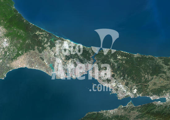
913_03_PO07516 Color satellite image of the Bosphorus Strait, Turkey. The Bosphorus Strait forms part of the continental boundary between Europe (left) and Asia (right) and connects the Black Sea (north) with the Sea of Marmara (south). Istanbul lies at the lower end of the Bosphorus Strait. Image collected on September 20, 2017 by Sentinel-2 satellites.
DC
913_03_PO07433 Color satellite image of Seoul, capital city of South Korea. It is situated on the Han River. Image collected on September 20, 2017 by Sentinel-2 satellites.
DC
913_03_PO07351 Color satellite image of Baku, capital city of Azerbaijan. The city is situated on the western coast of the Caspian Sea. Image collected on September 13, 2017 by Sentinel-2 satellites.
DC
913_03_PO07482 Color satellite image of Lisbon, capital city of Portugal. It is situated at the mouth of the Tagus River. Image collected on September 02, 2017 by Sentinel-2 satellites.
DC
913_03_PO07481 Color satellite image of Lisbon, capital city of Portugal. It is situated at the mouth of the Tagus River. Image collected on September 02, 2017 by Sentinel-2 satellites.
DC
913_03_PO07631 Color satellite image of Seattle, Washington, United States. It is a seaport city located between the Puget Sound to the west and Lake Washington to the east. Image collected on August 31, 2017 by Sentinel-2 satellites.
DC
913_03_PO07630 Color satellite image of Seattle, Washington, United States. It is a seaport city located between the Puget Sound to the west and Lake Washington to the east. Image collected on August 31, 2017 by Sentinel-2 satellites.
DC
913_03_PO07614 Color satellite image of Portland, Oregon, United States. The city lies at the confluence of the Willamette and Columbia Rivers. Image collected on August 31, 2017 by Sentinel-2 satellites.
DC
913_03_PO07613 Color satellite image of Portland, Oregon, United States. The city lies at the confluence of the Willamette and Columbia Rivers. Image collected on August 31, 2017 by Sentinel-2 satellites.
DC
71096_rf_28_prehistoric collection_196a4h An Advanced Civilization Using Time Travel To Capture & Transport Prehistoric Creatures To Another Time & Place To Prevent Their Extinction.
DC
71096_rf_28_prehistoric collection_196a3h An Advanced Civilization Using Time Travel To Capture & Transport Prehistoric Creatures To Another Time & Place To Prevent Their Extinction.
DC
71096_rf_28_prehistoric collection_196a2h An Advanced Civilization Using Time Travel To Capture & Transport Prehistoric Creatures To Another Time & Place To Prevent Their Extinction.
DC
71096_rf_28_prehistoric collection_195a1h An Advanced Civilization Using Time Travel To Capture & Transport Dinosaurs To Another Time & Place To Prevent Their Extinction.
DC
913_03_PO07573 Color satellite image of Geneva, Switzerland. The city is located at the south-western end of Lake Geneva. Image collected on August 21, 2017 by Sentinel-2 satellites.
DC
412-39466 Female design professional reviewing color swatches in office
RF
913_03_PO07492 Color satellite image of Kiev, capital city of Ukraine. Kiev is located on both sides of the Dnieper River. Image collected on August 11, 2017 by Sentinel-2 satellites.
DC
913_03_PO07471 Color satellite image of Rome, capital city of Italy. The Tiber flows through the city. Image collected on July 30, 2017 by Sentinel-2 satellites.
DC
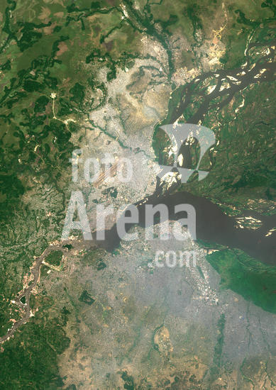
913_03_PO07348 Color satellite image of Brazzaville, capital city of the Republic of the Congo, and Kinshasa, capital city of the Democratic Republic of the Congo. Brazzavile is located on the north shore of the Congo River, while Kinshasa lies on the south shore. Image collected on September 19, 2017 by Sentinel-2 satellites.
DC
913_03_PO07332 Color satellite image of Brazzaville, capital city of Republic of the Congo. The city is on the north side of the Congo River. Image collected on July 12, 2017 by Sentinel-2 satellites.
DC
913_03_PO07432 Color satellite image of the West Region of Singapore. Image collected on July 10, 2017 by Sentinel-2 satellites.
DC
913_03_PO07431 Color satellite image of the eastern part of Singapore. Singapore Changi Airport is at the eastern end of the city. Image collected on July 10, 2017 by Sentinel-2 satellites.
DC
913_03_PO07430 Color satellite image of the western part of Singapore. Image collected on July 10, 2017 by Sentinel-2 satellites.
DC
913_03_PO07485 Color satellite image of Bratislava, capital city of Slovakia. The city is crossed by the Danube River. Image collected on June 20, 2017 by Sentinel-2 satellites.
DC
913_03_PO07575 Color satellite image of Basel in Switzerland, Mulhouse in France and Freiburg in Germany. The Rhine flows through this area. Image collected on June 19, 2017 by Sentinel-2 satellites.
DC
913_03_PO07574 Color satellite image of Basel, Switzerland. The Rhine flows through the city. EuroAirport Basel Mulhouse Freiburg is at west. Image collected on June 19, 2017 by Sentinel-2 satellites.
DC

Total de Resultados: 10.000

Página 1 de 100