


913_03_PO07684
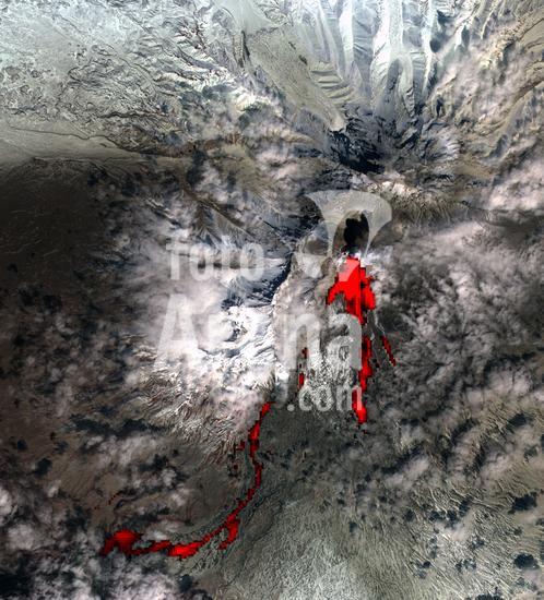
Color satellite image of Volcanoes on Kamchatka Peninsula, Russia. Klyuchevskaya, to the right, the tallest and most active volcano on the peninsula is emitting a small plume of gas, steam, and ash. Strecthing along the northwest rim of the Pacific Ring of Fire, Kamchatka is one of the most volcanically active regions in the world. Image collected on January 10, 2018.
DC