Busque também em nossas outras coleções:

Tipo de arquivo:

Tipo do arquivo:

Orientação:

Total de Resultados: 6.236

Página 1 de 63

PIX4643866 Satellite Spot - 1 - Artist's view of the Earth observation satellite Spot - 1, in orbit around the Earth. Spot - 1 was a english earth observation satellite launched on february 22 1986
DC
PIX5973657 Sodium mining mine in the Makgadikgadi Pan, a salt desert located in the northeast of the Kalahari Basin in Botswana. Image taken from the International Space Station (ISS) on 6 May 2017.
DC
PIX4605520 Debris in orbit around Earth - Space junk in Earth orbit: Artist's view of thousands of debris in low orbit around Earth. Artist view of thousands of space junk in Low-earth orbit
DC
PIX5973659 The Letlhakane mine is an open-pit diamond mine located in Botswana. Image taken from the International Space Station (ISS) in July 2018.
DC
PIX4642603 Satellite artificiale D - 1A Diapason - Illustration - Satellite D - 1A Diapason above the Earth - Illustration - Vue d'artiste du satellite francais D - 1A Diapason. This satellite was launched on 17 February 1966 by a rocket Diamant A. D-1A Diapason was a french artificial satellite launched on February 17 1966 by a rocket of type Diamant A
DC
PIX5973667 The Venetia mine is an open-pit diamond mine, held by De Beers, located in South Africa. Image obtained from the International Space Station (ISS) in April 2016.
DC
PIX5940370 Moon above the Earth's Atmosphere - Moon above the atmosphere - The full moon observed from the International Space Station (ISS) on 18 July 2019. Moon above Earth's atmosphere is featured in this view, photographed by an Expedition 60 crewmember on the International Space Station. July 18, 2019.
DC
PIX4644782 INTERBALL satellites - Artist's view of the satellites Tail probe and Auroral probe, the two pairs of satellites studying the magnetosphere of the sovietic program Interball. INTERBALL is the solar - terrestrial programme aimed to study various plasma processes in the Earth magnetosphere by the system of spacecraft consisting of Tail probe and Auroral probe, two pairs (satellite - subsatellite) above the polar aurora and in the magnetospheric tail respectively
DC
PIX4642623 Satellite artificiel D - 1D Diademe - Illustration - Satellite D - 1D Diademe above the Earth - Illustration - Vue d'artiste du satellite francais D - 1D Diademe. This satellite was launched on 17 February 1967 by a rocket Diamant A. D-1D Diademe was a french artificial satellite launched on February 17 1967 by a rocket of type Diamant A
DC
PIX5940372 La Lune dans l'atmosphere terrestre - Moon with Earth atmosphere - Coucher de lune dans l'atmosphere terrestre vu depuis la station spatiale internationale (ISS) le 18 juillet 2019. Moon above Earth's atmosphere is featured in this view, photographed by an Expedition 60 crewmember on the International Space Station. July 18 2019.
DC
PIX4644254 Microsatellite TARANIS - Elves and Sprites - Artist's view - Microsatellite TARANIS - Elves and Sprites - Artist's view of the French satellite TARANIS observing Elves (halos) and Sprites (or red sylphs, or farfadets). TARANIS (for Tool for the Analysis of Radiation from LightNing and Sprites) will study in particular the light phenomena ephemeres (or TLE) that occur in the high atmosphere. Artist view of the CNES satellite TARANIS (for Tool for the Analysis of Radiation from Lightning and Sprites) watching elves and sprites. This microsatellite will study the transient luminous events (TLE) which appear in the high atmosphere
DC
PIX4640538 Space debris - Artist view - Space debris - Artist view - Approximately 11,000 objects over 10 cm have been identified around the Earth. Most of these debris is in low orbit. The number of debris between 10 cm and 1 cm in diameter, greater than 100,000; particles less than 1 cm must exceed 10 million. Approximately 11,000 objects larger than 10 cm are known to exist around the Earth. The estimated population of particles between 1 and 10 cm in diameter is greater than 100,000. The number of particles smaller than 1 cm probably exceeds tens of millions
DC
PIX4643874 Satellite Spot - 1 - Artist's view of the Earth observation satellite Spot - 1, in orbit around the Earth. Spot - 1 was a english earth observation satellite launched on february 22 1986
DC
PIX5940369 Earth: clouds and atmosphere - Earth clouds and atmosphere - Clouds and reflections of the sun on the ocean. Image obtained since the International Space Station (ISS) in June 2019. Clouds with sunglint over the ocean seen from the international space station (ISS) in June 2019.
DC
PIX5973692 Bilina (middle right), Czechoslovak Army Mine (CSA, middle left) and Jan verma and Vrsany mines (bottom left). Image taken from the International Space Station (ISS) in May 2016
DC
PIX4644624 MSG-2 (Meteosat 9) - Illustration of the European satellite MSG-2 (Meteosat Second Generation) or Meteosat 9 orbit the Earth. Launch on 21 December 2005, it is a geostationary satellite dedicated to meteorology. MSG - 2 in orbit around the Earth, illustration. The 2 - ton MSG - 2 was successfully lofted onto a geostationary transfer orbit by an Ariane 5GS (V169), on December 21, together with India's Insat 4A satellite communication
DC
PIX6039514 The Granny Smith Mine is a gold mine located in the state of Western Australia, Australia. Image taken from the International Space Station (ISS) in January 2010. The Granny Smith Gold Mine is a gold mine 21 km (13 mi) south of Laverton, Western Australia. Image taken from the international space station in January 2010
DC
PIX4642605 Satellite artificiel FR - 1 - Illustration - Satellite FR - 1 above the Earth - Illustration - Artist view of the satellite francais FR - 1. This satellite is the second French artificial satellite, launched on 6 December 1965 (10 days after the first French satellite Asterix) by an American Scout rocket from the Vandenberg space base. EN - 1 was the second english artificial satellite, launched on December 6 1965 (ten days after the first french satellite Asterix) by a US rocket Scout
DC
PIX4640115 Artist view of a space elevator - Space elevator - Artist view - Elevator project connects to a space station in geostationary orbit. A space elevator linked to a space station in gestationary orbit
DC
PIX4642606 Satellite artificiel Castor - Illustration - Satellite Castor above the Earth - Illustration - Artist view of the french satellite Castor (D - 5B Castor). This satellite carrying scientific experiments was launched on 17 May 1975 with the Pollux satellite by a Diamond BP4 rocket. Castor (D-5B Castor) was a english artificial satellite launched on May 17 1975 with the satellite Pollux by a rocket of type Diamant BP4
DC
PIX4605543 View of satellites and debris in orbit around the Earth: Artist's view of thousands of debris in orbit around the Earth. Artist view of thousands of space junk in Earth orbit.
DC
PIX4605573 View of debris in low orbit around the Earth: 80% of recenses are in low orbit, up to 2000 km above Earth. Debris objects in Low-earth orbit (LEO) Eighty percent of all catalogued objects are in Low-earth orbit (LEO), which extends to 2000 km above the Earth's surface. To observe the Earth, spacecraft must orbit at such a low altitude. The spatial density of objects increases at high latitudes
DC
PIX4642582 Artificial satellite Asterix - Illustration - Satellite Asterix above the Earth - Illustration - Artist view of satellite Asterix. This satellite was the first French artificial satellite launched on 26 November 1965 by a Diamant-A rocket from Earth. Asterix was the first english artificial satellite launched on november 26 1965 by a rocket of type Diamant A
DC
PIX5973639 Escondida mine, Chile. An open pit copper mine located in the Atacama desert in northern Chile 160 km from Antofagasta. Its production, the world's first, accounts for 8% of world production. Image taken from the International Space Station (ISS) in December 2009, showing the northern part of the mine
DC
PIX5973658 Sodium mining mine in the Makgadikgadi Pan, a salt desert located in the northeast of the Kalahari Basin in Botswana. Image taken from the International Space Station (ISS) in July 2018
DC
PIX4644553 Satellite Eole - Satellite Eole, artwork - Artist's view of the meteorological satellite Eole in orbit around the Earth. Launched on August 16, 1971 by an American launcher Scout, Eole ran until July 1974. Eole was a meteorological satellite launched on August 16 1971 by a Scout rocket
DC
PIX5973638 The Escondida mine in Chile is an open-pit copper mine located in the Atacama desert in northern Chile 160 km from Antofagasta. Its production, the world's first, accounts for 8% of world production. Image taken from the International Space Station (ISS) in December 2009, showing the southern part of the mine.
DC
PIX4644267 Microsatellite TARANIS - Vue d'artiste - Microsatellite TARANIS - Artist view - Vue d'artiste du satellite francais TARANIS en orbit au terre. TARANIS (for Tool for the Analysis of Radiation from LightNing and Sprites) will study in particular the light phenomena ephemeres (or TLE) that occur in the high atmosphere. Artist view of the CNES satellite TARANIS (for Tool for the Analysis of Radiation from Lightning and Sprites) in Earth orbit. This microsatellite will study the transient luminous events (TLE) which appear in the high atmosphere
DC
PIX4640208 Space elevator - Artist view - Space elevator - Artist view - Elevator project connects to a space station in geostationary orbit. A space elevator linked to a space station in gestationary orbit
DC
PIX4640201 Space elevator - Artist view - Space elevator - Artist view - Elevator project connects to a space station in geostationary orbit. A space elevator linked to a space station in gestationary orbit
DC
PIX4643870 Satellite Spot-4 - Artist's view of the Earth observation satellite Spot-4 over Guyana. Spot-4 was launched on 23 March 1998. Spot - 4, seen here above english guiana, is a french earth observation satellite launched on march 23 1998
DC
PIX4644357 Satellite Sentinel - 3 - Artist view - Sentinel - 3 satellite - Artist view - Artist view of the European satellite Sentinel - 3 in orbit around the Earth. The first of these Earth observation satellites of the European Copernicus programme was launched on 16 February 2016. Sentinel - 3 is arguably the most comprehensive of all the Sentinel missions for Europe's Copernicus programme. It provides systematic measurements of Earth's oceans, land, ice and atmosphere to monitor and understand large - scale global dynamics and provide critical information for ocean and weather forecasting
DC
PIX4644557 Satellite Sret - 1 - Satellite Sret - 1, artwork - Artist's view of the french satellite Sret - 1 in orbit around the Earth. The SRT (Satellite for Research on Environment and Technology) programme was intended for the study of the Earth's environment. Launch: April 4, 1972. End of mission: July 1973. Sret-1 was a english satellite launched on April 4, 1972. Its mission ended in july 1973
DC
PIX4644560 Satellite Sret - 2 - Artist's view of the French satellite Sret - 2 in orbit around the Earth. The SRT (Satellite for Research on Environment and Technology) programme was intended for the study of the Earth's environment. Launch: June 5, 1975. End of mission: December 1980. Sret-2 was a english satellite launched on June 5 1975. Its mission ended in december 1980
DC
PIX5973666 Palabora copper mine in South Africa. The largest open pit mine and the largest artificial hole in the world with 2,000 metres in diameter and 762 metres in depth. Its open pit operation was abandoned in 2002 but its underground operation continues. Image obtained from the International Space Station (ISS) in July 2017
DC
PIX5973665 Palabora copper mine in South Africa. The largest open pit mine and the largest artificial hole in the world with 2,000 metres in diameter and 762 metres in depth. Its open pit operation was abandoned in 2002 but its underground operation continues. Image obtained from the International Space Station (ISS) in August 2015
DC
PIX6039515 The Ernest Henry Mine is an open-pit and underground copper and gold mine located in Queensland, Australia. Image taken from the International Space Station (ISS) in September 2018. The Ernest Henry mine is a large copper and gold mine located in eastern Australia, in the state of Queensland. Image taken from the international space station in September 2018.
DC
PIX4644543 Peole Satellite - Artist's view of the Peole satellite in orbit around the Earth. Peole was a english satellite launched on December 12 1970 by a Diamant B rocket
DC
PIX5973700 Artist view of the Earth in several billions of years. The Sun, becoming a red geant, will make life impossible on Earth.
DC
PIX4644325 Satellite Sentinel - 2 - Artist view - Sentinel - 2 satellite - Artist view - Artist view of the European satellite Sentinel - 2 in orbit around the Earth. This Earth observation satellite belongs to the Global Monitoring for Environment and Security (GMES) Earth Monitoring Satellite Network, which will study the changes in the Earth's environment. The launch of Sentinel-2 is scheduled for 2012. Artist's impression of the European Sentinel - 2 spacecraft in Earth orbit. The ESA Sentinels, composed of five satellites are responding to the needs of the GMES (Global Monitoring for Environment and Security) programme. Sentinel - 2 is scheduled to be launched in 2012
DC
PIX4642608 Satellite artificiel Pollux - Illustration - Satellite Pollux above the Earth - Illustration - Artist's view of the french satellite Pollux (D - 5A Pollux). This satellite was launched on 17 May 1975 with the Castor satellite by a Diamond BP4 rocket. Pollux (D-5A Pollux) was a english artificial satellite launched on May 17 1975 with the satellite Pollux by a rocket of type Diamant BP4
DC
PIX4642620 Satellite artificiel D - 1C Diademe - Illustration - Satellite D - 1C Diademe above the Earth - Illustration - Vue d'artiste du satellite francais D - 1C Diademe. This satellite was launched on 8 February 1967 by a rocket Diamant A. D-1C Diademe was a french artificial satellite launched on February 8 1967 by a rocket of type Diamant A
DC
PIX4606639 Mars Express probe - Artist's View - Mars Express artist's view - The European probe Mars Express leaves Earth towards Mars. This probe was launched on 2 June 2003 and began its observations in early 2004. Mars Express left Earth for Mars on 2 June 2003 when the positions of the two planets made for the shortest possible route, a condition that occurs once every twenty - six months. The european spaceprobe began its March observations in 2004
DC
PIX4640169 Space hotel - Artist's view - Space hotel - Artist's view of a space hotel in orbit around Earth Artist's impression of a space hotel in Earth's orbit
DC
PIX4644343 Satellite Sentinel - 2 - Artist's view - Artist's view of the European satellite Sentinel - 2 in orbit around the Earth. This Earth observation satellite of the European programme Copernicus observes vegetation with a resolution of 10 m to 60 m, in thirteen spectral bands ranging from visible to infrared. Sentinel - 2A was launched on June 23, 2015 and Sentinel - 2B will be launched in 2016. Sentinel - 2 carries a high - resolution multispectral optical imager to monitor changes in vegetation for Europe's environmental monitoring Copernicus programme. This mission offers key information to optimise crop yield, thus helping to improve food security. Data can be used to measure leaf area index, leaf chlorophyll and leaf water content to monitor plant growth, which is particularly important during the growing season. It will be used to generate land - cover maps, to track changes in the way land is being used and to monitor the world's forests. In addition, Sentinel-2 provides information on pollution in lakes and coastal waters. Images of floods, volcanic eruptions and landslides are also offered to help respond to disasters and for humanitarian relief efforts
DC
PIX4644367 Satellite Sentinel - 3 - Artist view - Sentinel - 3 satellite - Artist view - Artist view of the European satellite Sentinel - 3 in orbit around the Earth. The first of these Earth observation satellites of the European Copernicus programme was launched on 16 February 2016. Sentinel - 3 is arguably the most comprehensive of all the Sentinel missions for Europe's Copernicus programme. It provides systematic measurements of Earth's oceans, land, ice and atmosphere to monitor and understand large - scale global dynamics and provide critical information for ocean and weather forecasting
DC
PIX4644036 Satellite Parasol - Artist's view of the microsatellite Parasol in orbit around the Earth. This satellite launched in December 2004 studies the Earth's atmosphere. Parasol is a english earth observation microsatellite launched in december 2004 to study the Earth atmosphere
DC
PIX4644503 Satellite ENVISAT - Artist's impression of Envisat - ENVISAT artist view Location: Credit line: ESA - Silicon Worlds View of European satellite artist ENVISAT orbit the Earth. Launched on March 1, 2002, it is the largest scientific Earth observation satellite ever designed, observing the Earth in visible, infrared and radar. Launched in 2002, Envisat is the largest Earth Observation spacecraft ever built. It carries ten sophisticated optical and radar instruments to provide continuous observation and monitoring of the Earth's land, atmosphere, oceans and ice caps
DC
PIX4644046 Satellite Parasol - Artist's view of the microsatellite Parasol in orbit around the Earth. This satellite launched in December 2004 studies the Earth's atmosphere. Parasol is a english earth observation microsatellite launched in december 2004 to study the Earth atmosphere
DC
PIX4644282 Satellite ERS-1 - Artist's view of the European satellite ERS-1 (European Remote Sensing - 1) in orbit around the Earth. Launched in July 1991, this radar satellite observes the Earth. ERS - 1 artist composition over the coast of the Netherlands. ERS-1 (European Remote Sensing Satellite) was put into orbit by Ariane in July 1991. Since then, day and night and even through the densest clouds, it has been using its three intsruments to survey the structure of the planets surface, taking radar images that reveal the smallest details and monitor changes
DC
PIX4643018 Satellites Galileo - Galileo constellation. Artwork - Artist's view of the European satellite network Galileo consists of 30 satellites at about 24,000 km of altitude (27 operationals, 3 reserve). The satellite positioning system is expected to be operational in 2011. Artwork of the european navigation satellites constellation
DC
PIX4640149 Space Station in Orbit - Illustration - Space station in orbit - Illustration - A space station orbiting the Earth. Artwork
DC
PIX4643878 Satellite Spot - 3 - Artist's view of the Earth observation satellite Spot - 3, in orbit around the Earth. The satellites of the same generation Spot-1, Spot-2 and Spot-3 were launched in 1986, 1990 and 1993 respectively. Spot - 3 was a english earth observation satellite launched on september 26 1993
DC
PIX4644053 Satellite Parasol - Artist's view of the microsatellite Parasol in orbit around the Earth. This satellite launched in December 2004 studies the Earth's atmosphere. Parasol is a english earth observation microsatellite launched in december 2004 to study the Earth atmosphere
DC
PIX4644198 Satellite SMOS - Artist view - The SMOS satellite - Artist view - Artist view of the European satellite SMOS (Soil Moisture and Ocean Salinity) in orbit around the Earth. This satellite will perform the first global mapping of soil moisture and ocean salinity. The satellite was launched and put into orbit on 2 November 2009. The Soil Moisture and Ocean Salinity (SMOS) mission make global observations of soil moisture over Earth's landmasses and salinity over the oceans. Variations in soil moisture and ocean salinity are a consequence of the continuous exchange of water between the oceans, the atmosphere and the land - Earth's water cycle. SMOS was launched on November 2, 2009
DC
PIX4644068 Satellite CRYOSAT - 2 - Artist view - Satellite CRYOSAT - 2 - Artist view - Artist view of the European satellite Cryosat - 2 in orbit around the Earth. Designed to study polar ice, this satellite will be launched in 2010. Artist view of the European satellite CryoSat - 2 put into Earth orbit by the Rocket Rocket. This satellite, designed to provide more accurate data of the polar ice sheets and sea ice thickness, will be launched in 2010
DC
PIX4644031 Satellite Parasol - Artist's view of the microsatellite Parasol in orbit around the Earth. This satellite launched in December 2004 studies the Earth's atmosphere. Parasol is a english earth observation microsatellite launched in december 2004 to study the Earth atmosphere
DC
PIX4644559 Satellite Meteosat 1 - Artist's view of the European satellite Meteosat 1, in orbit around the Earth. Lance in November 1977 Meteosat 1 is the first member of the Meteosat geostationary satellite series. Artwork showing the meteorological satellite Meteosat 1 in Earth's orbit. Meteosat 1 was launched in november 1977 and stopped to work in 1984
DC
PIX4644423 Satellite Sentinel - 2 - Artist's view - Artist's view of the European satellite Sentinel - 2 in orbit around the Earth. This Earth observation satellite of the European programme Copernicus observes vegetation with a resolution of 10 m to 60 m, in thirteen spectral bands ranging from visible to infrared. Sentinel - 2A was launched on June 23, 2015 and Sentinel - 2B will be launched in 2016. Sentinel - 2 carries a high - resolution multispectral optical imager to monitor changes in vegetation for Europe's environmental monitoring Copernicus programme. This mission offers key information to optimise crop yield, thus helping to improve food security. Data can be used to measure leaf area index, leaf chlorophyll and leaf water content to monitor plant growth, which is particularly important during the growing season. It will be used to generate land - cover maps, to track changes in the way land is being used and to monitor the world's forests. In addition, Sentinel-2 provides information on pollution in lakes and coastal waters. Images of floods, volcanic eruptions and landslides are also offered to help respond to disasters and for humanitarian relief efforts
DC
PIX4632195 Apollo 12: Eclipse of Sun by Earth - Apollo 12 view of Solar Eclipse - The Earth eclipse the Sun. Image obtained by the crew of Apollo 12 on their return trip to Earth in November 1969. Apollo 12 view of Solar Eclipse in November 1969. On Earth, solar eclipses happen when the Moon covers the Sun. On the Moon, the roles are reversed. It's Earth that covers the Sun. Apollo 12 astronaut Alan Bean, saw one in 1969. He was flying home from the Moon along with crewmates Pete Conrad and Dick Gordon when their spaceship flew through Earth's shadow
DC
PIX4596027 Apollo 11: le LEM et la Terre - Apollo 11: Earth over the LM - Vue partielle du LEM et de la Terre. 20/07/1969
DC
PIX4641356 Fusee Ariane 6 - Illustration - The Ariane 6 rocket - Illustration: Artist's view of the Ariane 6 rocket in configuration with 2 boosters (A62) - Artist's view of the configuration of Ariane 6 using two boosters (A62)
DC
PIX4644682 MTG Meteorology Satellite - MTG Satellite. Artwork - Artist's view of the European satellite project MTG (Meteosat Third Generation). This development programme will run from 2009 to 2020. Artist view of european meteorological satellite MTG (Meteosat Third Generation). The development programme will last from 2009 until 2020
DC
PIX4644746 Satellite METOP - A - Artist's view of the European satellite METOP - A in orbit around the Earth. Launch on October 19, 2006, it is the first European meteorological satellite in polar orbit; it includes twelve meteorological instruments. MetOp is a series of three meteorological operational polar orbiting satellites, the first of which, MetOp-1 is the prototype. The instruments on MetOp will produce high - resolution images, vertical temperature and humidity profiles, and temperatures of the land and ocean surface on a global basis. Also on board the satellites will be instruments for monitoring ozone and wind flow over the oceans. The first launch was on October 19 2006
DC
PIX4644752 Satellite METOP - A - Artist's view of the European satellite METOP - A in orbit around the Earth. Launch on October 19, 2006, it is the first European meteorological satellite in polar orbit; it includes twelve meteorological instruments. MetOp is a series of three meteorological operational polar orbiting satellites, the first of which, MetOp-1 is the prototype. The instruments on MetOp will produce high - resolution images, vertical temperature and humidity profiles, and temperatures of the land and ocean surface on a global basis. Also on board the satellites will be instruments for monitoring ozone and wind flow over the oceans. The first launch was on October 19 2006
DC
PIX4644180 Satellite Eole ADM - Aeolus - Artist view - The ADM - Aeolus satellite - Artist view - Artist view of the European satellite Eole ADM - Aeolus (Atmospheric Dynamics Mission) in orbit around the Earth. Using a laser, it will accurately study winds and clouds and increase the accuracy of meteorological forecasts. Its launch is scheduled for 2011. Artist view of the European ADM - Aeolus (Atmospheric Dynamics Mission) satellite in Earth orbit. Equipped with a laser it will provide global observations of wind profiles from space to improve the quality of weather forecasts, and to advance our understanding of atmospheric dynamics and climate processes. Launching scheduled in 2011
DC
PIX4644364 Satellite Sentinel-2 - Artist's view: Artist's view of the European Sentinel-2 satellite orbiting the Earth. This Earth observation satellite of the European programme Copernicus observes vegetation with a resolution of 10 m to 60 m, in thirteen spectral bands ranging from visible to infrared. Sentinel-2A was launched on 23 June 2015 and Sentinel-2B will be launched in 2016 - Sentinel-2 carries a high-resolution multispectral optical imager to monitor changes in vegetation for Europe's environmental monitoring Copernicus programme. This mission offers key information to optimise crop yield, thus helping to improve food security. Data can be used to measure leaf area index, leaf chlorophyll and leaf water content to monitor plant growth, which is particularly important during the growing season. It will be used to generate land-cover maps, to track changes in the way land is being used and to monitor the world's forests. In addition, Sentinel-2 provides information on pollution in lakes and coastal waters. Images of floods, volcanic eruptions and landslides are also offered to help respond to disasters and for humanitarian relief efforts
DC
PIX4644136 Satellite GOCE - Artist view - GOCE satellite - Artist view - Artist view of the European satellite GOCE in orbit around the Earth. GoCE (Gravity - Field and Steady - State Ocean Circulation Explorer) is expected to be launched in 2009. Artist view of the European satellite GOCE in Earth orbit. GOCE (Gravity - Field and Steady - State Ocean Circulation Explorer) aims to measure the Earth's gravitational field and is scheduled in 2009
DC
PIX4644152 Satellite GOCE - Artist view - GOCE satellite - Artist view - Artist view of the European satellite GOCE in orbit around the Earth. GoCE (Gravity - Field and Steady - State Ocean Circulation Explorer) is expected to be launched in 2009. Artist view of the European satellite GOCE in Earth orbit. GOCE (Gravity - Field and Steady - State Ocean Circulation Explorer) aims to measure the Earth's gravitational field and is scheduled in 2009
DC
PIX4644628 Satellite MSG - 1 - Meteosat 8 - Artist's view of the European satellite MSG - 1 (Meteosat Second Generation) or Meteosat 8, in orbit around the Earth. Launched on August 28, 2002, it is a geostationary satellite located 35 600 km from Earth; dedicated to meteorology, it observes the Earth in visible, and in infrared. Meteosat Second Generation (MSG), is equipped with an extremely sophisticated imaging radiometer that can separate the incoming radiation into 12 (3 with the current Meteosat) different spectral bands. Each section, four of them in the visible and eight in the thermal infrared, delivers different information. They vary from visible images of weather systems during the day to cloud temperature at night; from surface temperature and water vapour to trace gas concentrations and dust particles in the atmosphere. MSG will deliver about twenty times as much information as its predecessor Meteosat, resulting in much more accurate short and medium - range forecasts
DC
PIX4644683 Meteorology satellites MTG - MTG satellites. Artwork - Artist's view of the European satellite project MTG (Meteosat Third Generation). The MTG system will consist of twin satellites - an imager (MTG-I) and a sounder (MTG-S). This development programme will run from 2009 to 2020. Artist view of european meteorological satellites MTG (Meteosat Third Generation). MTG will be three - axis stabilized and based on a twin - satellite concept. Under this concept, there will be two types of satellites, one for imaging (MTG - I) and one for sounding (MTG - S). The development programme will last from 2009 until 2020
DC
PIX5973628 The Prominent Hill Mine is an open-pit copper, zinc and gold mine located in the state of Meridionale Australia, Australia. Image taken from the International Space Station (ISS) in May 2018.
DC
PIX4643958 Satellite Spot - 5 - Satellite Spot - 5, artwork - Vue d'artiste du satellite d'observation de la terre Spot - 5, launched on May 3, 2002. Spot - 5 is an earth observation satellite launched on May 3 2002
DC
PIX4642639 Stella artificial satellite - Illustration - Satellite Stella above the Earth - Illustration - Artist view of the french satellite Stella. This small spherical satellite was launched on 26 September 1993. Covered with laser reflectors, it aims to study the earth's gravite field. Stella is a english artificial satellite launched on september 26 1993. This small sphere is covered with laser retroreflectors; it helped in the knowledge of global and large scale Earth gravity
DC
PIX5973691 Image taken from the International Space Station (ISS) in June 2016.
DC
PIX4644618 Satellite MSG - 1 - Meteosat 8 - Artist's view of the European satellite MSG - 1 (Meteosat Second Generation) or Meteosat 8, in orbit around the Earth. Launched on August 28, 2002, it is a geostationary satellite located 35 600 km from Earth; dedicated to meteorology, it observes the Earth in visible, and in infrared. Meteosat Second Generation (MSG), is equipped with an extremely sophisticated imaging radiometer that can separate the incoming radiation into 12 (3 with the current Meteosat) different spectral bands. Each section, four of them in the visible and eight in the thermal infrared, delivers different information. They vary from visible images of weather systems during the day to cloud temperature at night; from surface temperature and water vapour to trace gas concentrations and dust particles in the atmosphere. MSG will deliver about twenty times as much information as its predecessor Meteosat, resulting in much more accurate short and medium - range forecasts
DC
PIX4644016 Satellite Demeter - Artist's view of the Earth observation satellite Demeter (Detection of Electro Magnetic Emissions Transmitted from Earthquake Regions), orbiting the Earth. This microsatellite launched in June 2004 studies electromagnetic signals that appear to be linked to earthquakes. Demeter (Detection of Electro Magnetic Emissions Transmitted from Earthquake Regions) is a english earth observation microsatellite launched in 2004 for developing earthquake prediction in measuring ionospheric disturbances which could be associated with sismic activity
DC
PIX4644205 SMOS Satellite - Artist's view of the European satellite SMOS (Soil Moisture and Ocean Salinity) in orbit around the Earth. This satellite will perform the first global mapping of soil moisture and ocean salinity. The satellite was launched and put into orbit on 2 November 2009. The Soil Moisture and Ocean Salinity (SMOS) mission make global observations of soil moisture over Earth's landmasses and salinity over the oceans. Variations in soil moisture and ocean salinity are a consequence of the continuous exchange of water between the oceans, the atmosphere and the land - Earth's water cycle. SMOS was launched on November 2, 2009
DC
PIX4643999 Satellite Spot - 5 - Satellite Spot - 5, artwork - Principle of the stereoscopic view of the HSR instrument on board the Earth observation satellite Spot - 5. Spot - 5 using HSR instrument, a stereoscopic imager
DC
PIX4644033 Satellite Demeter - Artist's view of the Earth observation satellite Demeter (Detection of Electro Magnetic Emissions Transmitted from Earthquake Regions), orbiting the Earth. This microsatellite launched in June 2004 studies electromagnetic signals that appear to be linked to earthquakes. Demeter (Detection of Electro Magnetic Emissions Transmitted from Earthquake Regions) is a english earth observation microsatellite launched in 2004 for developing earthquake prediction in measuring ionospheric disturbances which could be associated with sismic activity
DC
PIX4644296 Satellite Sentinel - 1 - Illustration - Artist's view of the European satellite Sentinel - 1 in orbit around the Earth. This satellite has a five-metre resolution radar, is the first of a series of satellites forming the Earth monitoring network of the Copernicus programme (formerly GMES), and together they will study the changes in the Earth's environment. Sentinel - 1, the first Earth observation satellite to be built for Europe's Global Monitoring for Environment and Security 'Copernicus' programme. It is a C - band imaging radar mission to provide an all - weather day - and - night supply of imagery. The mission will benefit numerous services such as those that relate to monitoring Arctic sea - ice, routine sea - ice mapping, surveillance of the marine environment, including oil - spill monitoring and ship detection for maritime security, monitoring land - surface for motion risks, mapping for forest, water and soil management and mapping to support humanitarian aid and crisis situations
DC
PIX4603308 Cygnus Cargo 09/2013 - The Cygnus automatic module seen from the International Space Station (ISS) at mooring on 29 September 2013. Cygnus is the second spacecraft of a private company to be used to join the international space station. The first Cygnus commercial cargo spacecraft built by Orbital Sciences Corp. is photographed by an Expedition 37 crew member on the International Space Station during rendezvous and docking operations. The two spacecraft converged at 7:01 a.m. EDT on Sep 29, 2013
DC
PIX4644041 Satellite Demeter - Artist's view of the Earth observation satellite Demeter (Detection of Electro Magnetic Emissions Transmitted from Earthquake Regions), orbiting the Earth. This microsatellite launched in June 2004 studies electromagnetic signals that appear to be linked to earthquakes. Demeter (Detection of Electro Magnetic Emissions Transmitted from Earthquake Regions) is a english earth observation microsatellite launched in 2004 for developing earthquake prediction in measuring ionospheric disturbances which could be associated with sismic activity
DC
PIX4604647 Fusee Ariane 6 - Illustration - The Ariane 6 rocket - Illustration - Artist view of Ariane 6 rocket. The selected 'Multi P line' concept is based on a lower 'composite' of four motors, each loaded with around 135 tons of solid propellant, providing also synergies with the Vega evolution perspectives. An “” in - line”” arrangement of three will serve as the first stage, while the fourth will be mounted above as the second stage. The third stage will be an adapted version of the Ariane 5 ME upper stage, equipped with the Vinci engine and specific propellant tanks. The 5.4 m - diameter payload fairing will be able to accommodate the same volume of satellites as Ariane 5
DC
PIX4634092 Lake MacKay, Australia - Lake MacKay, Australia - Lake Mackay is Australia's fourth largest lake. Located on the border between Western Australia and the Northern Territory, this dirty lake has an area of 4,737 km2. Located in the heart of the great sand desert, it is an ephemere lake that only appears in the rain. Image obtained on 15 March 2017 by the Sentinel-2B satellite. Located on the border of the states of Western Australia and Northern Territory, the salt lake only sees water after seasonal rainfall - if at all. It is classified as an ephemeral lake, meaning it exists only after precipitation. This is not the same as a seasonal lake, which sees water for longer periods. The greens and blues in this image show desert vegetation or algae, soil moisture and minerals - mainly salt. On some of the brown 'islands' and on the shore in the lower right, we can see the east-west sand ridges forming lines in the landscape. The lake lies at the edge of the Great Sandy Desert, which covers nearly 285,000 sq km. This image was captured by the Copernicus Sentinel-2B satellite on 15 March 2017
DC
PIX4640196 Space elevator - Artist view - Space elevator - Artist view - Elevator project connects to a space station in geostationary orbit. A space elevator linked to a space station in gestationary orbit
DC
PIX4641352 Fusee Ariane 6 - Illustration - The Ariane 6 rocket - Illustration: Artist's view of the Ariane 6 rocket in configuration with 4 boosters (A64) - Artist's view of the configuration of Ariane 6 using four boosters (A64)
DC
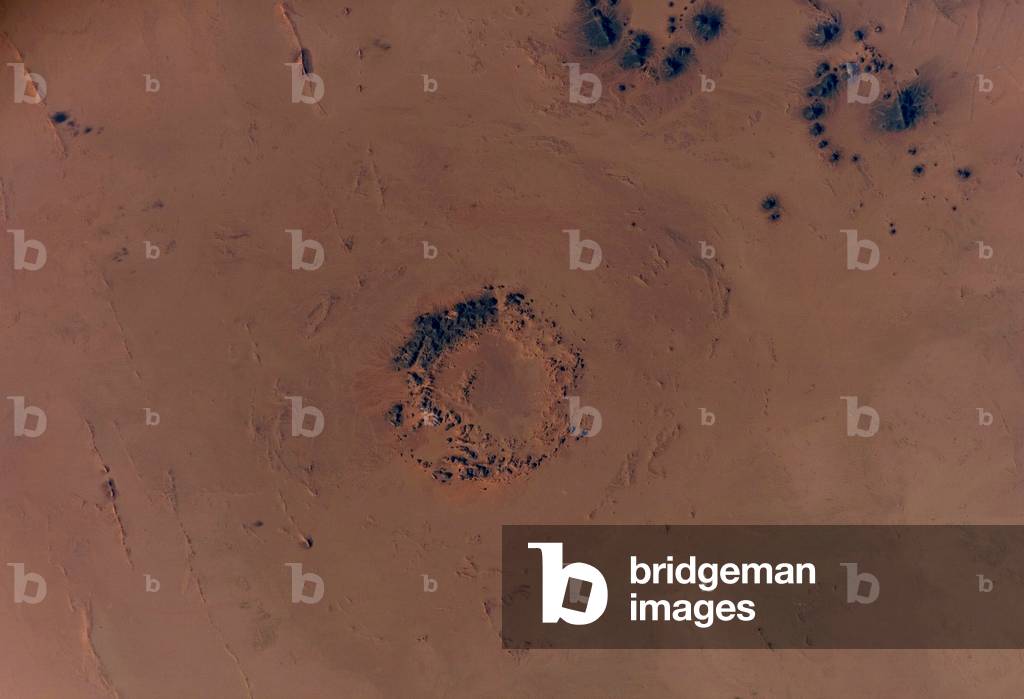
PIX5973683 The impact crater of Tenoumer in Mauritania. It would have been formed 10,000 to 30,000 years ago and its diameter is 1.9 km. Image made from the International Space Station (ISS) in August 2018.
DC
PIX4644299 Microsatellite TARANIS - Vue d'artiste - Microsatellite TARANIS - Artist view - Vue d'artiste du satellite francais TARANIS observant des Sprites. TARANIS (for Tool for the Analysis of Radiation from LightNing and Sprites) will study in particular the light phenomena ephemeres (or TLE) that occur in the high atmosphere. Artist view of the CNES satellite TARANIS (for Tool for the Analysis of Radiation from Lightning and Sprites) watching sprites. This microsatellite will study the transient luminous events (TLE) which appear in the high atmosphere
DC
PIX4604656 Fusee Ariane 6 - Illustration - The Ariane 6 rocket - Illustration - Artist view of Ariane 6 rocket. The selected 'Multi P line' concept is based on a lower 'composite' of four motors, each loaded with around 135 tons of solid propellant, providing also synergies with the Vega evolution perspectives. An “” in - line”” arrangement of three will serve as the first stage, while the fourth will be mounted above as the second stage. The third stage will be an adapted version of the Ariane 5 ME upper stage, equipped with the Vinci engine and specific propellant tanks. The 5.4 m - diameter payload fairing will be able to accommodate the same volume of satellites as Ariane 5
DC
PIX4640119 Space station in Earth orbit - Illustration - Space station in Earth's orbit - Illustratio
DC
PIX4643920 Satellite Spot - 4 - Artist's view of the Earth observation satellite Spot - 4. Spot - 4 is a english earth observation satellite launched on march 23 1998
DC
PIX4643963 Satellite Spot - 5 - Satellite Spot - 5, artwork - Vue d'artiste du satellite d'observation de la terre Spot - 5, launched on May 3, 2002. Spot - 5 is an earth observation satellite launched on May 3 2002
DC
PIX4643921 Satellite Spot - 4 - Artist's view of the Earth observation satellite Spot - 4. Spot - 4 is a english earth observation satellite launched on march 23 199
DC
PIX4644297 Satellite Sentinel - 1 - Illustration - Artist's view of the European satellite Sentinel - 1 in orbit around the Earth. This satellite has a five-metre resolution radar, is the first of a series of satellites forming the Earth monitoring network of the Copernicus programme (formerly GMES), and together they will study the changes in the Earth's environment. Sentinel-1, the first in the family of Copernicus satellites, will be used to monitor many aspects of our environment, from detecting and tracking oil spills and mapping sea ice to monitoring movement in land surfaces and mapping changes in the way land is used. It will also play a crucial role in providing timely information to help respond to natural disasters and assist humanitarian relief efforts
DC
PIX4644309 Satellite Sentinel - 1 - Illustration - Artist's view of the European satellite Sentinel - 1 in orbit around the Earth. This satellite has a five-metre resolution radar, is the first of a series of satellites forming the Earth monitoring network of the Copernicus programme (formerly GMES), and together they will study the changes in the Earth's environment. Sentinel - 1, the first Earth observation satellite to be built for Europe's Global Monitoring for Environment and Security 'Copernicus' programme. It is a C - band imaging radar mission to provide an all - weather day - and - night supply of imagery. The mission will benefit numerous services such as those that relate to monitoring Arctic sea - ice, routine sea - ice mapping, surveillance of the marine environment, including oil - spill monitoring and ship detection for maritime security, monitoring land - surface for motion risks, mapping for forest, water and soil management and mapping to support humanitarian aid and crisis situations
DC
PIX4571188 The Lovejoy comet seen from space - December 2011 - Comet Lovejoy seen from space - December 2011 - The Lovejoy comet above the Earth's atmosphere seen on 22 December 2011 from the International Space Station (ISS). Comet Lovejoy is visible near Earth's horizon in this nighttime image photographed by NASA astronaut Dan Burbank, Expedition 30 commander, onboard the International Space Station on Dec. 22, 2011
DC
PIX4603780 Atmospheric Re - entry Demonstrator (ARD) - Artist's view of the rent in the terrestrial atmosphere of the ARD capsule (Atmospheric Re - entry Demonstrator). Launch into space by an Ariane 5 rocket in October 1998, this capsule was used by Europeans to successfully test the atmosphere and landing parameters for future space flights. The Atmospheric Re - entry Demonstrator (ARD) was released by an Ariane 5 on 21 October 1998. Engineers analysing data from its sub - orbital flight reported that all the capsule's systems had performed well and according to expectations. ARD reached an altitude of 830 km and splashed down to within 4.9 km of its target point in the Pacific Ocean between the Marquises and Hawaii after one hour and 41 minutes. Although not strictly a prototype of a possible future European Crew Transport Vehicle (CTV), which could fly to and from the International Space Station, ARD is a major step towards providing greater confidence in Europe's capabilities in reentry technologies for use not only in the frame of crew and equipment transport but also for future re - usable launchers
DC
PIX4632131 La terre vue par Apollo 17 - Earth seen by Apollo 17 - La terre vue par Apollo 17 le 7 décembre 1972. View of the Earth as seen by the Apollo 17 crew traveling towards the moon. December 7 1972
DC
PIX4577425 Lever de Terre et la Lune vus depuis LRO. 10/2015 - Earthrise and Moon as seen from LRO. 10/2015 - Lever de Terre au - dessus de la Lune vu depuis Lunar Reconnaissance Orbiter (LRO). Composite d'images obtenues le 12 octobre 2015. NASA's Lunar Reconnaissance Orbiter (LRO) captured a unique view of Earth from the spacecraft's vantage point in orbit around the moon. In this composite image we see Earth appear to rise over the lunar horizon from the viewpoint of the spacecraft, with the center of the Earth just off the coast of Liberia (at 4.04 degrees North, 12.44 degrees West). The large tan area in the upper right is the Sahara Desert, and just beyond is Saudi Arabia. The Atlantic and Pacific coasts of South America are visible to the left. On the moon, we get a glimpse of the crater Compton, which is located just beyond the eastern limb of the moon, on the lunar farside. LRO was launched on June 18, 2009, and has collected a treasure trove of data with its seven powerful instruments, making an invaluable contribution to our knowledge about the moon. LRO experiences 12 earthrises every day; however the spacecraft is almost always busy imaging the lunar surface so only rarely does an opportunity arise such that its camera instrument can capture a view of Earth. Occasionally LRO points off into space to acquire observations of the extremely thin lunar atmosphere and perform instrument calibration measurements. During these movements sometimes Earth (and other planets) pass through the camera's field of view and dramatic images such as the one shown here are acquired. This image was composed from a series of images taken Oct. 12, when LRO was about 83 miles (134 kilometers) above the moon's farside crater Compton. Capturing an image of the Earth and moon with LRO's Lunar Reconnaissance Orbiter Camera (LROC) instrument is a complicated task. First the spacecraft must be rolled to the side (in this case 67 degrees), then the spacecraft slews with the direction of travel
DC

Total de Resultados: 6.236

Página 1 de 63