Busque também em nossas outras coleções:

Tipo de arquivo:

Tipo do arquivo:

Orientação:

Total de Resultados: 111

Página 1 de 2

UIG601787 Johannesburg, South Africa. True colour satellite image of the city of Johannesburg, taken on 1 July 2002, using LANDSAT 7 data.
DC
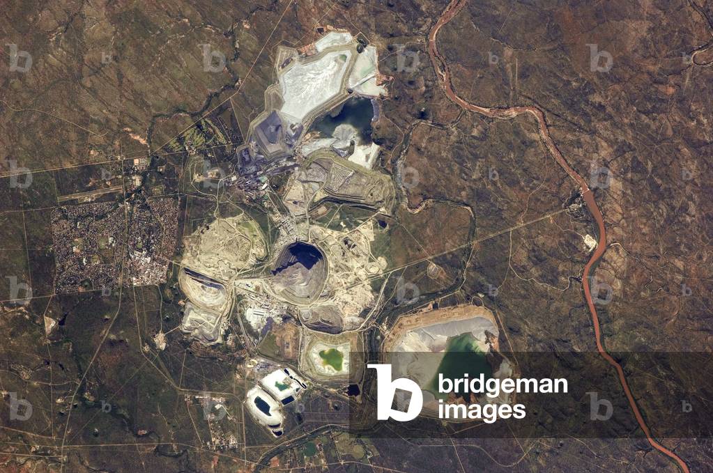
PIX5940236 Palabora Mine - South Africa - Phalaborwa Copper Mine - Republic South Africa - The Palabora Copper Mine in South Africa is the largest open-pit mine and the largest artificial hole in the world with 2,000 metres in diameter and 762 metres in depth. Its open pit operation was abandoned in 2002 but its underground operation continues. Image obtained by Landsat 8 satellite in July 2019. The mine pictured here has been growing vertically and horizontally near Phalaborwa, South Africa, for more than 50 years. The Landsat 8 satellite acquired this image of the Palabora mine in July 2019. It is South Africa's largest open-pit mine, measuring almost 2 kilometers wide.
DC
PIX4658332 Africa seen from space - Africa seen from space - Southern Africa seen from space. Composite satellite photos and computer illustration. Artwork composed from satellite photographs and computer generated images
DC
UIG602030 True colour satellite image of Saltpan impact structure, Pretoria, South Africa (diameter : 1,13 km). Image taken on 7 September 1991 using LANDSAT data.
DC
PIX4659268 Irrigation on the Orange River - Irrigation along the Orange River. Orange marks the border between South Africa and Namibia. Image obtained by satellite EO-1 on 15 February 2010. The Orange River serves as part of the border between Namibia and the Republic of South Africa. Along the banks of this river, roughly 100 kilometers (60 miles) inland from where the river empties into the Atlantic Ocean, irrigation projects take advantage of water from the river and soils from the floodplains to grow produce, turning parts of a normally earth - toned landscape emerald green. The Advanced Land Imager (ALI) on Nasa's Earth Observing - 1 (EO - 1) satellite captured this true - color image on February 15, 2010. A network of bright rectangles of varying shades of green contrasts with surroundings of gray, beige, tan, and rust
DC
UIG674676 Satellite view of South Africa in Africa with country borders. This image was compiled from data acquired by LANDSAT satellite.
DC
UIG601661 South Africa, true colour satellite image with mask. This image was compiled from data acquired by LANDSAT 5 & 7 satellites.
DC
UIG520484 True colour satellite image of Vredefort impact structure, South Africa (diameter : 140 km). Composite image of LANDSAT data taken on 7 April 1991 and 30 April 1991.
DC
UIG521328 South Africa, true colour satellite image with border. This image was compiled from data acquired by LANDSAT 5 & 7 satellites.
DC
UIG521327 South Africa, true colour satellite image. This image was compiled from data acquired by LANDSAT 5 & 7 satellites.
DC
UIG521329 South Africa, true colour satellite image with mask and border. This image was compiled from data acquired by LANDSAT 5 & 7 satellites.
DC
UIG674888 Satellite view of South Africa. This image was compiled from data acquired by LANDSAT satellite.
DC
UIG674674 Relief map of South Africa in Africa with country borders. This map was processed from elevation data.
DC
UIG674675 Relief map of South Africa in Africa with country borders. This map was processed from elevation data.
DC
PIX4632390 Earth by Satellite - Earth by Satellite - Earth Planisphere. Image obtained by Terra and Aqua satellites. Earth planisphere. Satellite image
DC
UIG521859 Satellite view of Lesotho with Bump Effect (with border). This image was compiled from data acquired by LANDSAT 5 & 7 satellites.
DC
UIG521861 Satellite view of Lesotho (with border). This image was compiled from data acquired by LANDSAT 5 & 7 satellites.
DC
PFH1173139 The Republic of Sudan ( Arabic: Jumho
DC
UIG521858 Satellite view of Lesotho with Bump Effect (with border and mask). This image was compiled from data acquired by LANDSAT 5 & 7 satellites.
DC
UIG521860 Satellite view of Lesotho (with border and mask). This image was compiled from data acquired by LANDSAT 5 & 7 satellites.
DC
UIG674886 Relief map of South Africa. This map was processed from elevation data.
DC
UIG674680 Satellite view of South Sudan in Africa with country borders. This image was compiled from data acquired by LANDSAT satellite.
DC
UIG674678 Relief map of South Sudan in Africa with country borders. This map was processed from elevation data.
DC
UIG674679 Relief map of South Sudan in Africa with country borders. This map was processed from elevation data.
DC
PIX4632360 Earth by satellite - Earth by satellite - Bathymetric and topographic map of the Earth. February month. Planisphere showing Earth in February
DC
UIG866670
DC
PIX4632354 Earth by satellite - Earth by satellite - Bathymetric and topographic map of the Earth. Month of July. Planisphere showing Earth in July
DC
UIG522117 Satellite view of South Sudan (with border). This image was compiled from data acquired by LANDSAT 5 & 7 satellites.
DC
UIG522108 Satellite view of South Africa (with border and mask). This image was compiled from data acquired by LANDSAT 5 & 7 satellites.
DC
UIG522116 Satellite view of South Sudan (with border and mask). This image was compiled from data acquired by LANDSAT 5 & 7 satellites.
DC
UIG522109 Satellite view of South Africa, Lesotho and Swaziland (with border). This image was compiled from data acquired by LANDSAT 5 & 7 satellites.
DC
UIG601796 Cape Town, South Africa. True colour satellite image of the city of Cape Town. Composite of 2 images taken on 3 June 2002 & 13 June 2000, using LANDSAT 7 data.
DC
UIG3275123 Satellite view of South Sudan (with country boundaries). This image was compiled from data acquired by Landsat satellites.
DC
PIX4631859 Earth with starry sky - Earth with starry sky - Image of the Earth recomposed from different satellite images. A star background has been added. Composite images obtained with data collected from Terra and Aqua satellites. A starry sky background was added
DC
UIG3275134 Satellite view of South Sudan (with country boundaries and mask). This image was compiled from data acquired by Landsat satellites.
DC
UIG601757 Cape Town, South Africa. True colour satellite image of the city of Cape Town. Composite of 2 images taken on 3 June 2002 and 13 June 2000, using LANDSAT 7 data.
DC
UIG3274365 Satellite view of Africa. This image was compiled from data acquired by Landsat 7 & 8 satellites.
DC
UIG3274863 Satellite view of Northeast Africa (with country boundaries). This image was compiled from data acquired by Landsat 7 & 8 satellites.
DC
UIG3274366 Satellite view of Africa (with country boundaries). This image was compiled from data acquired by Landsat 7 & 8 satellites.
DC
UIG3275133 Satellite view of Sudan and South Sudan (with country boundaries). This image was compiled from data acquired in 2014 by Landsat 8 satellite.
DC
PIX4658522 Volcano Fogo - Cape Verde - Volcano Fogo - Cape Verde islands - Fogo Island with its highest volcano 2800 meters south of the Cape Verde archipelago. Image obtained by Terra satellite on 27 August 2002. Image taken by the satellite Terra on August 27, 2002
DC
UIG3275125 Satellite view of Southern Africa. It shows the African Great Lakes region. This image was compiled from data acquired by Landsat 7 & 8 satellites.
DC
UIG3275111 Satellite view of Southern Africa (with country boundaries). It shows the African Great Lakes region. This image was compiled from data acquired by Landsat 7 & 8 satellites.
DC
PIX4659459 Lake Chad seen by satellite in 2007 - Lake Chad as seen by satellite in 2007 - Lake Chad seen by Envisat satellite on 19 December 2007. This Envisat image highlights Lake Chad, a freshwater lake located in central Africa at the junction of Chad, Cameroon, Nigeria and Niger. Lake Chad, once Africa's third largest inland water body, is located in West Africa's Sahel region - a transition zone between the Sahara Desert to the north and savannas and woodlands to the south. Because the lake is shallow, between 1 m in the northwest and 7 m in the south, it has always undergone seasonal fluctuations. However, it has shrunk dramatically over the last four decades due to a decrease in rainfall and an increase in the amount of water used for irrigation projects. Lake Chad's surface area was 25 000 sq km in the early 1960s, compared with 1350 sq km in 2001. Lake Chad is fed primarily by the Chari and Logone Rivers, which are both located in the southwest and flow northward into the lake, which doubles in size during the rainy season. This 19 December 2007 image was acquired by the Medium Resolution Imaging Spectrometer (MERIS) instrument on Envisat, working in Full Resolution mode
DC
UIG521857 Relief map of Lesotho (with border). This image was compiled from data acquired by LANDSAT 5 & 7 satellites combined with elevation data.
DC
UIG521856 Relief map of Lesotho (with border and mask). This image was compiled from data acquired by landsat 5 & 7 satellites combined with elevation data.
DC
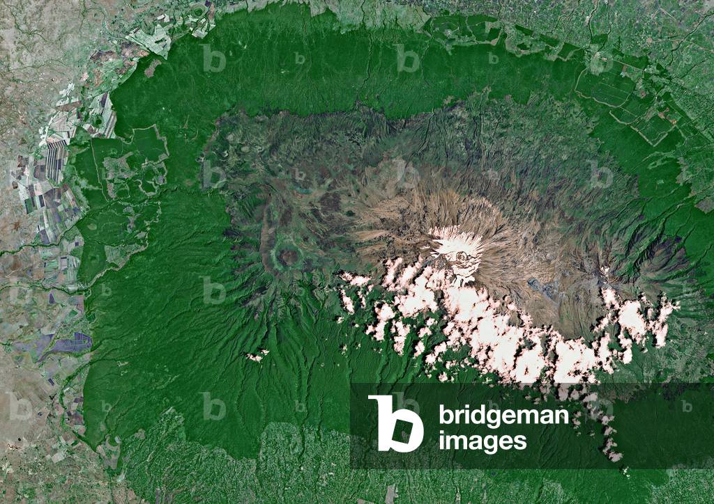
UIG601912 Portions of Kenya and Tanzania, Africa, can be seen in this image. The peak of Kilimanjaro is on the right; the mountain is flanked by the plains of Amboseli National Park to the north and the rugged Arusha National Park to the south and west. Image taken on 25 February 1987 using LANDSAT data.
DC
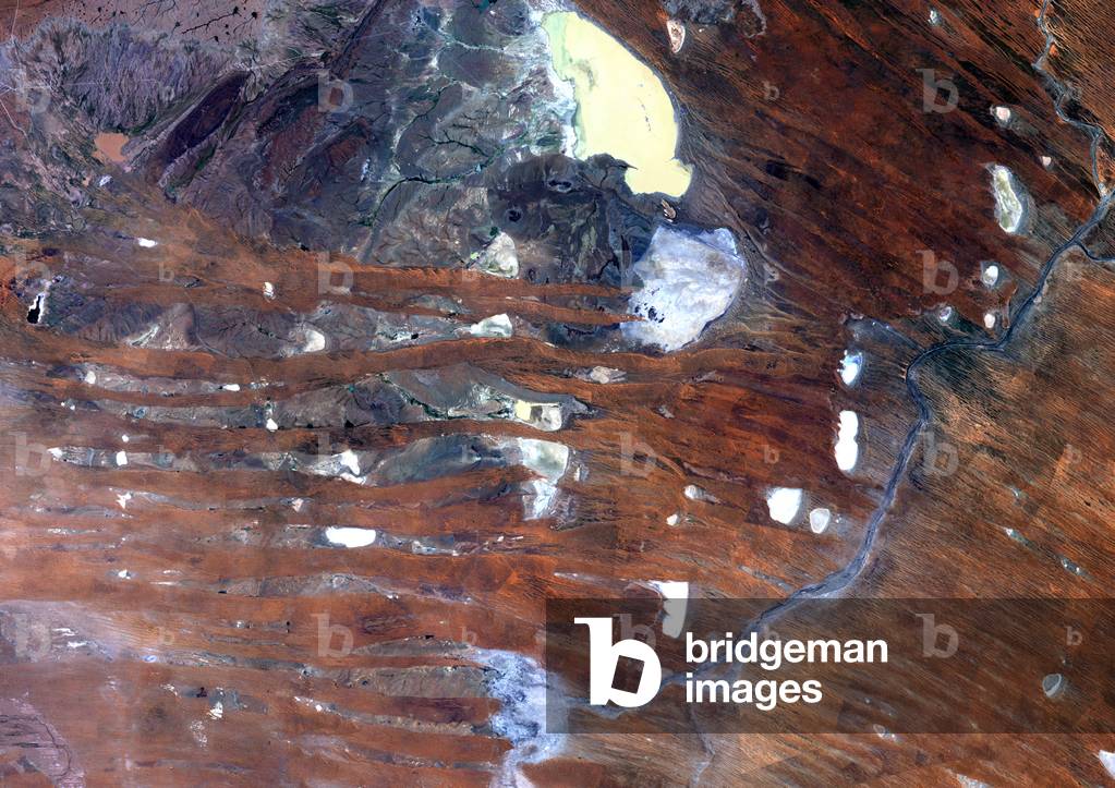
UIG601887 True colour satellite image of the Kalahari desert, at the frontier between Namibia and South Africa. The dunes are red-coloured by iron oxyds. The blue dots are argillakeeous basins, still filled with water. The white dotes are salted basins that show how dry this plakee is. Image taken on 3 March 1989 using LANDSAT data.
DC
UIG523477 Relief map of South Africa (with border and mask). This image was compiled from data acquired by landsat 5 & 7 satellites combined with elevation data.
DC
UIG601889 Rub Al Khali, a sand desert South East of Saudi Arabia ; sand dunes are sculptured and moved by the winds, in blue the argillakeeous subsoil, and in white the salt crusts left out by the oueds in the rainy season.
DC
UIG3275005 Satellite view of Eastern Africa (with country boundaries). The image shows River Nile from Lake Victoria to its delta in Northern Egypt. This image was compiled from data acquired by Landsat 7 & 8 satellites.
DC
UIG3275004 Satellite view of Eastern Africa. The image shows River Nile from Lake Victoria to its delta in Northern Egypt. This image was compiled from data acquired by LANDSAT 7 & 8 satellites.
DC
PIX4658526 Volcano Fogo - Cape Verde - Volcano Fogo - Cape Verde islands - Fogo Island with its highest volcano 2800 meters south of the Cape Verde archipelago. Image obtained from the EO-1 satellite on 10 June 2009. Fogo is one of the Cape Verde Islands located roughly 640 kilometers off the westernmost tip of Africa, Fogo received its name from English colonists around 1500 AD. The Advanced Land Imager on Nasa's EO - 1 satellite captured this detailed image of the volcano on June 10, 2009. The volcano's most distinctive feature, its nine - kilometer wide caldera, Cha Caldera, is shown in this image. The eastern half of the crater wall is gone, erased in a massive collapse deep in its ancient history. In the center of the crater, a steep cone named Pico rises about 100 meters above the crater rim (more than a kilometer from the crater floor). The young peak reaches 2,829 meters (9,281 feet) above sea level, making it the island's highest point. The crater is inhabited. A straight road cuts between the crater wall and Pico, ending near the wind that erupted in 1995. Bright white dots on the north side of the crater are villages. Residents of the Cha Caldera evacuated during the eruption
DC
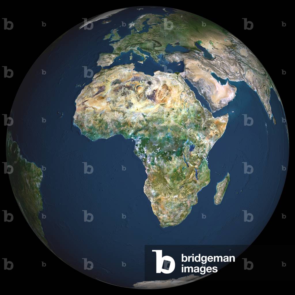
UIG601605 Earth. True colour satellite image of the Earth, centred on Africa. North is at top. Water is blue, vegetation is green, arid areas are brown, and snow and ice are white. Both land and ocean floor topography are shown. The terrain of Africa varies from rock and sand (grey and brown) in the Sahara in North Africa, to tropical rainforests (dark green) in Western and Central Africa, to savannah and plains (brown and green) in southern and eastern Africa. Surrounding Africa (clockwise from top) is Europe and the Mediterranean, the Arabian Peninsula, the Indian Ocean and the island of Madagascar, and the Atlantic Ocean. At the edge of the globe are India (upper right), Antarctica (bottom), South America (lower left) and Greenland (top). The image used data from LANDSAT 5 & 7 satellites. Print size 42x42cm.
DC
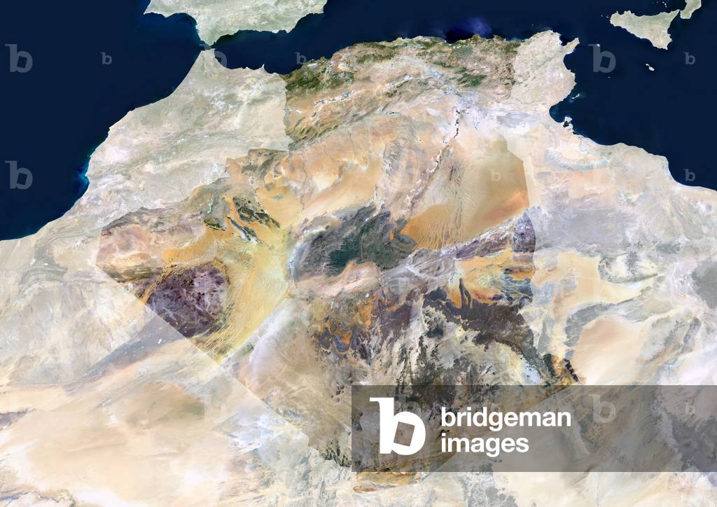
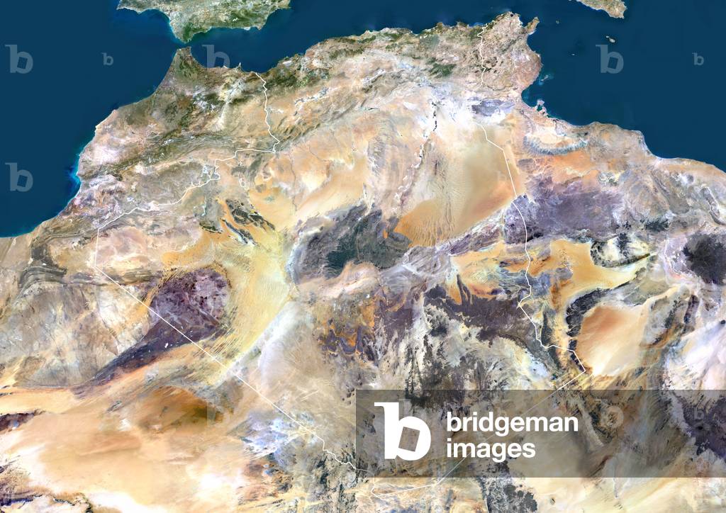
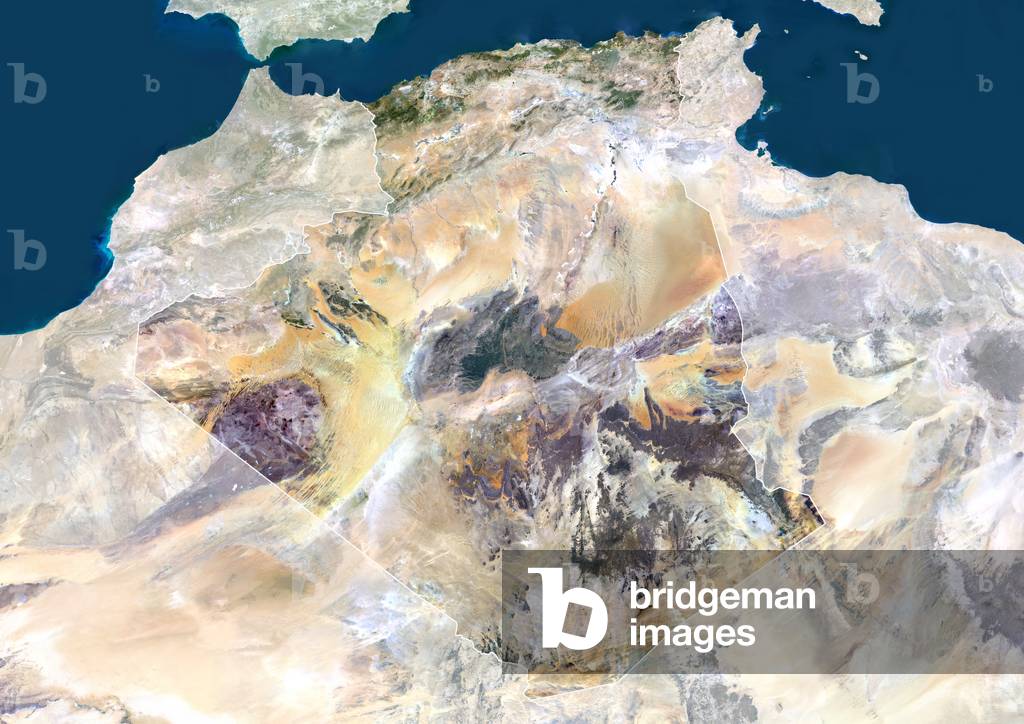
UIG601652 Algeria, true colour satellite image with mask. North is at top. Most of the coastal area is hilly, sometimes even mountainous. The area just south of the coast is fertile. Further south is the Atlas mountain range and the Sahara desert. Algiers, Oran and Constantine are the main cities.This image was compiled from data acquired by LANDSAT 5 & 7 satellites.
DC
UIG521330 Algeria, true colour satellite image with border. North is at top. Most of the coastal area is hilly, sometimes even mountainous. The area just south of the coast is fertile. Further south is the Atlas mountain range and the Sahara desert. Algiers, Oran and Constantine are the main cities.This image was compiled from data acquired by LANDSAT 5 & 7 satellites.
DC
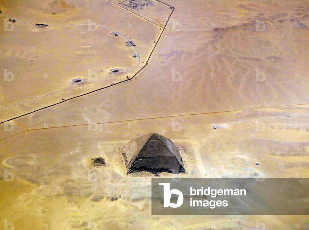
UIG3507795 Satellite view of the Bent Pyramid, Egypt. This distinctive shaped ancient Egyptian pyramid is located at the royal necropolis of Dahshur, approximately 40 kilometres south of Cairo. It was built under the Old Kingdom Pharaoh Sneferu (c. 2600 BC). A unique example of early pyramid development in Egypt, this was the second pyramid built by Sneferu.
DC
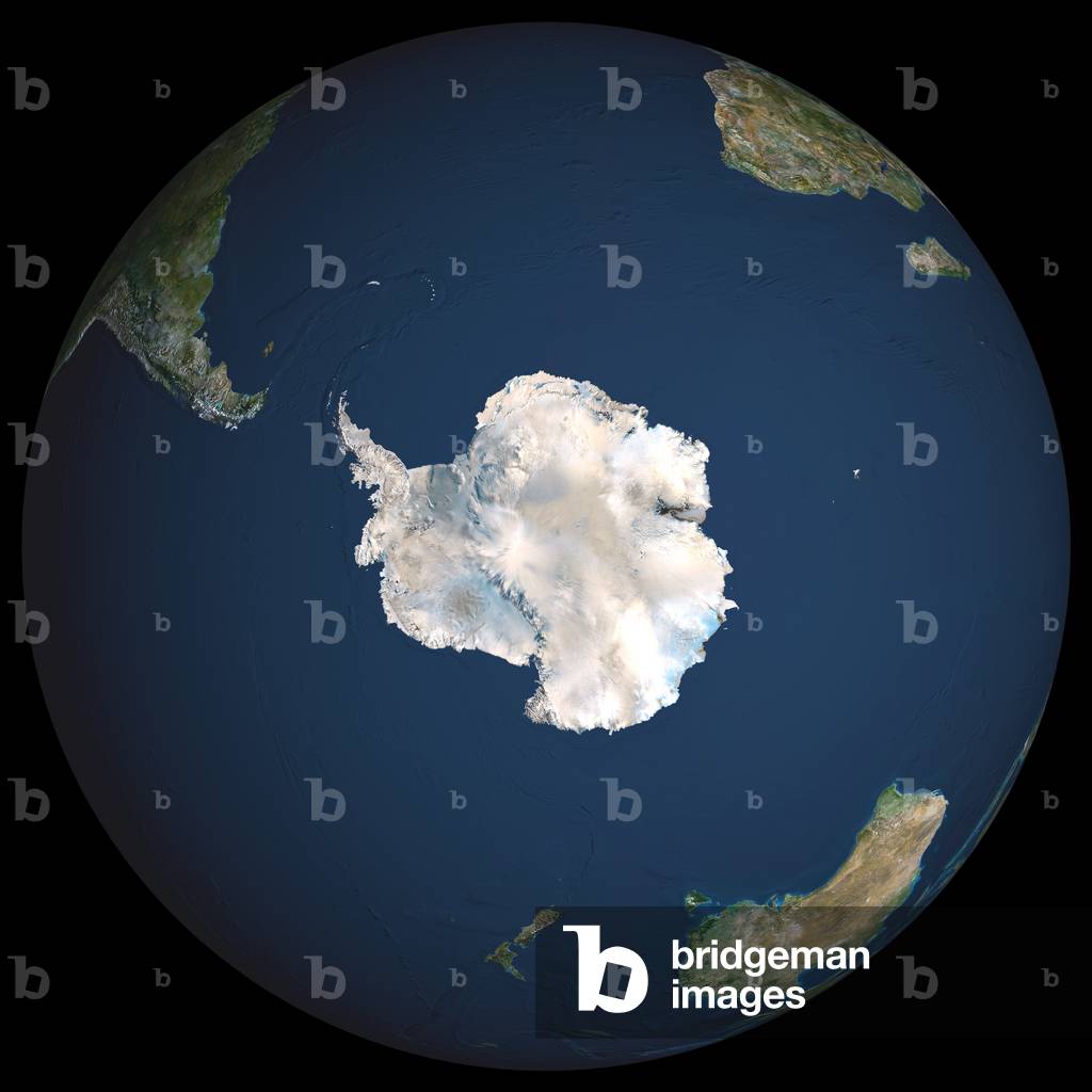
UIG601606 Earth. True colour satellite image of the Earth, centred on Antarctica. The South Pole is at centre. Antarctica is a frozen continent, permanently covered in snow and ice. Surrounding Antarctica are the waters of the Southern Ocean, mixing with the Atlantic Ocean (upper centre), the Pacific Ocean (lower left) and the Indian Ocean (centre right). Around the edge of the hemisphere is New Zealand (lower centre), Australia (lower right), and the southern parts of Africa (upper right, the island of Madagascar is also seen) and South America (upper left). The image used data from LANDSAT 5 & 7 satellites. Print size 42x42cm.
DC
PIX4659243 South Africa seen from space - South Africa seen from space - South Africa seen from space - South Africa seen by the shuttle Discovery in March 2001. Republic of South Africa seen from the space shuttle Discovery in march 2001
DC
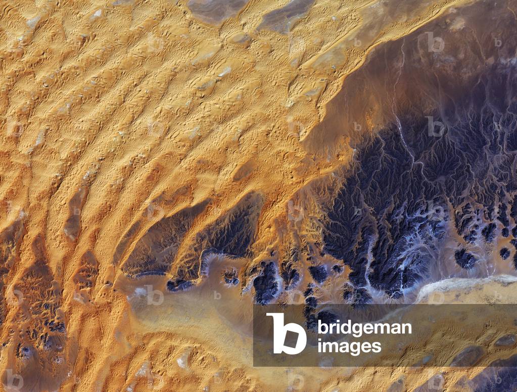
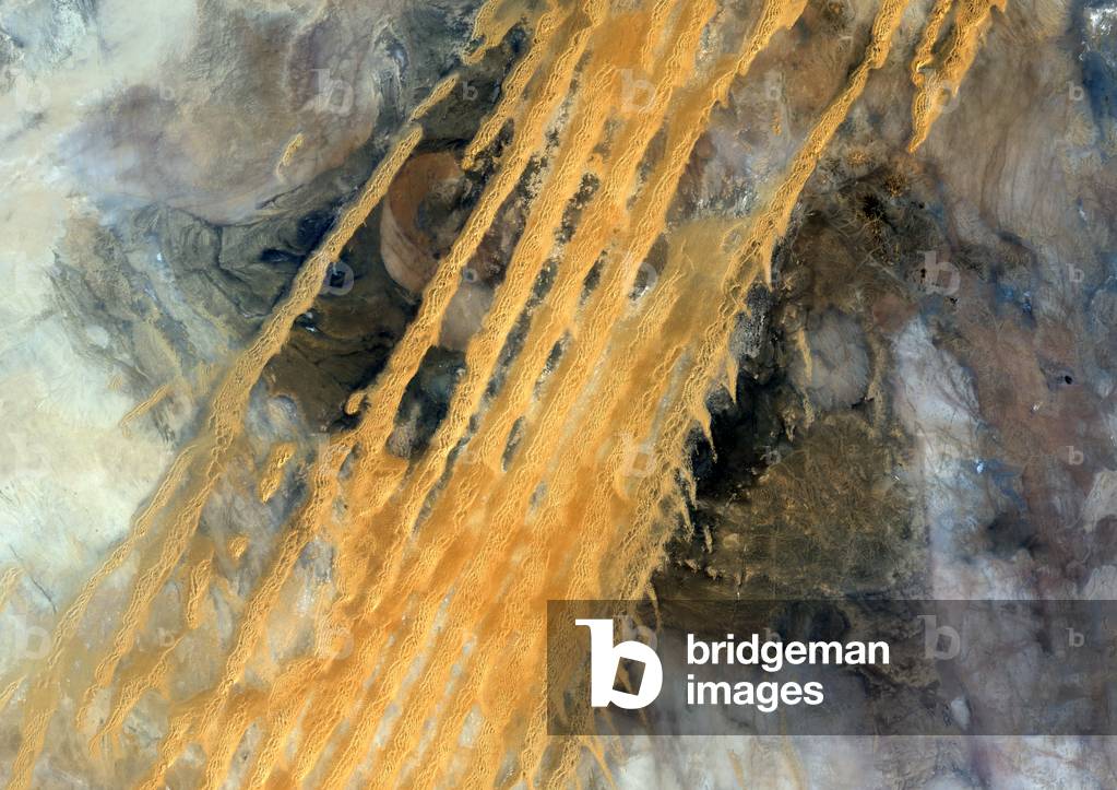
PIX4630452 Algerian Sahara seen by satellite - Algerian Sahara seen from space: Part of the Sahara desert, in southeast Algeria. The Japanese satellite ALOS (Advanced Land Observation Satellite) took this image on 28 January 2011. This satellite image was captured over southeastern Algeria in the heart of the Sahara desert. In this image, a large area of rock appearing purple stretches across the right side of the image, with fluvial erosion patterns testament to an earlier time when the area received more rainfall. Today, this area sees an average of about 10 mm of rainfall per year. Windshaped sand dunes are visible on the left. The area at the bottom appears to be flat, with tiny specks of vegetation. Just south of this image lies the Tassili n 'Ajjer National Park and UNESCO World Heritage Site, renowned for its 10 000 year-old cave art. The drawings and engravings depict culture and the environment from a time when climatic conditions were more favourable to human occupation. Japan's ALOS satellite recorded this image on 28 January 2011
DC
UIG520888 Satellite view of Pakistan (with mask). This image was compiled from data acquired by LANDSAT 5 & 7 satellites.
DC
UIG520652 Satellite view of Pakistan (with border). This image was compiled from data acquired by LANDSAT 5 & 7 satellites.
DC
PIX4659278 Palabora Mine - South Africa - Phalaborwa Copper Mine - Republic South Africa - The Palabora Copper Mine in South Africa is the largest open pit mine and the largest artificial hole in the world with 2,000 metres in diameter and 762 metres deep. Image obtained from the International Space Station (ISS) in December 2009. Palabora Mining Company Limited's open cast mine is Africa's widest man-made hole at almost 2,000 meters wide. Seen from the international space station in december 2009
DC
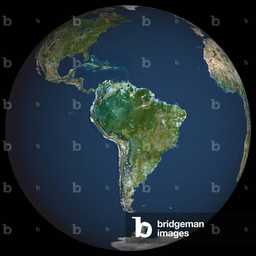
UIG601602 Earth. True colour satellite image of the Earth, centred on South America. North is at top. Water is blue, vegetation is green, arid areas are brown, and snow and ice are white. Both land and ocean floor topography are shown. The terrain of South America is marked by the Andes mountains along the western coast, tropical rainforests (dark green) in the Amazon river basin in the north, and swamps and plains (lighter green) in the south. Surrounding South America (clockwise from upper left) is North America and the Caribbean islands, the Atlantic Ocean (right) and the Pacific Ocean (left). Parts of Greenland, Europe, Africa and Antarctica are also seen on the edges of the globe. The image used data from LANDSAT 5 & 7 satellites. Print size 42x42cm.
DC
UIG523479 Relief map of South Sudan (with border and mask). This image was compiled from data acquired by landsat 5 & 7 satellites combined with elevation data.
DC
PIX4632011 Earth seen by satellite - Earth seen by satellite - Mosaic of Earth images obtained by the Suomi NPP satellite in April 2015. On the right, cyclone Joalane passes over the Indian Ocean. This natural - color composite image of Earth was assembled from data acquired by the Visible Infrared Imaging Radiometer Suite (VIIRS) on the Suomi National Polar - orbiting Partnership (Suomi - NPP) spacecraft. It stitches together 671, 551, and 443 nanometer wavelength data from six orbits on April 9, 2015. Suomi NPP does not actually observe Earth from the perspective shown in this image. The satellite flies in a polar orbit at an altitude of 824 kilometers (512 miles), and its images have a resolution of 750 meters per pixel. In the image, the virtual camera looks down from the perspective of 8,300 kilometers (5,100 miles) above a point at 50 degrees South latitude and 40 degrees East longitude. Most of the scene is filled by the Indian Ocean (center and left), while parcels of the Atlantic (top left) and Southern Ocean (bottom) fill in the rest and remind us that it is all really one ocean. The image also includes southern Africa and Madagascar, with tropical cyclone Joalane swirling in the Indian Ocean
DC
UIG522106 Relief map of South Africa (with border and mask). This image was compiled from data acquired by landsat 5 & 7 satellites combined with elevation data.
DC
UIG521331 Algeria, true colour satellite image with mask and border. North is at top. Most of the coastal area is hilly, sometimes even mountainous. The area just south of the coast is fertile. Further south is the Atlas mountain range and the Sahara desert. Algiers, Oran and Constantine are the main cities.This image was compiled from data acquired by LANDSAT 5 & 7 satellites.
DC
PIX4659267 Sishen Mine - South Africa - Sishen Mine - Republic South Africa - The Sishen Iron Mine in South Africa seen from the International Space Station (ISS) on March 23, 2016. Sishen mine, seen from the international space station on March 23 2016. The Sishen mine is a large iron mine located in central South Africa in Kathu, Northern Cape. Sishen represents one of the largest iron ore reserves in South Africa and in the world
DC
UIG2613809 South Africa at night in 2012. This satellite image shows urban and industrial lights.
DC
UIG522107 Relief map of South Africa, Lesotho and Swaziland (with border). This image was compiled from data acquired by LANDSAT 5 & 7 satellites combined with elevation data.
DC
UIG522114 Relief map of South Sudan (with border and mask). This image was compiled from data acquired by landsat 5 & 7 satellites combined with elevation data.
DC
PIX4659279 Sishen Mine - South Africa - Sishen Mine - Republic South Africa - The Sishen Iron Mine in South Africa seen from the International Space Station (ISS) on March 23, 2016. Sishen mine, seen from the international space station on March 23 2016. The Sishen mine is a large iron mine located in central South Africa in Kathu, Northern Cape. Sishen represents one of the largest iron ore reserves in South Africa and in the world
DC
UIG522115 Relief map of South Sudan (with border). This image was compiled from data acquired by LANDSAT 5 & 7 satellites combined with elevation data.
DC
UIG520653 Satellite view of Pakistan (with border and mask). This image was compiled from data acquired by LANDSAT 5 & 7 satellites.
DC
PIX4658382 Algerian Sahara seen by satellite - Algerian Sahara seen from space - The Tanezrouft Basin is one of the most desolate regions of the Sahara Desert, in southern Algeria. The Tanezrouft region is characterised by its hills of dark gres, its subdued canyons, its stretches of salt (in white), its rocky plateaus, the concentric loop patterns of its storey outcrops and its seas with sand dunes as tall as buildings and which are called ergs. The Erg Mehedjibat, which appears here as a bouquet of yellow flowers (at the top right), is made up of small star dunes that grow in height rather than horizontally. The Japanese satellite ALOS (Advanced Land Observation Satellite) took this image on 24 June 2009 using its camera AVNIR - 2 (Advanced Visible and Near Infrared Radiometer type - 2) which was designed to map emergeal lands and vegetation with a resolution of 10 m. The image shows the extraordinary landscape of the Tanezrouft Basin, one of the most desolate parts of the Sahara desert, in south - central Algeria. The region is known as 'land of terror' because of its lack of water and vegetation. As visible, this region is characterised by dark sandstone hills, steep canyon walls, salt flats (white), stone plateaus, sandstone outcrop patterns of concentric loops and sprawling seas of multi - storey sand dunes known as 'ergs'. Erg Mehedjibat, which appears as a yellow bouquet of flowers (upper right), is made up of a cluster of small star dunes that grow upward rather than laterally. Japan's ALOS (Advanced Land Observing Satellite) captured this image on 24 June 2009 with its Advanced Visible and Near Infrared Radiometer type - 2 (AVNIR - 2) instrument.
DC
PIX4665869 Detroit of Gibraltar seen by satellite - Strait of Gibraltar seen from space - The Detroit of Gibraltar seen by Envisat satellite on 18 June 2003. To the north, Spain and the rock of Gibraltar at the end of the tip (right), to the south, Morocco. A view of Morocco and the Strait of Gibraltar acquired by the Medium Resolution Imaging Spectrometer (MERIS) onboard ESA's Envisat environmental monitoring satellite, on June 18, 2003
DC
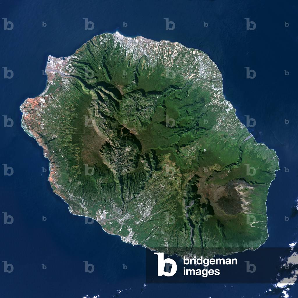
UIG602001 Piton de la Fournaise, Reunion, true colour satellite image. 3D satellite view of the Piton de la Fournaise (2631m), one of the world's most active volcanoes, located on the South East part of Reunion Island, in the Indian Ocean. Image using LANDSAT data.
DC
UIG2613810 South Africa at night in 2012. This satellite image with country borders shows urban and industrial lights.
DC
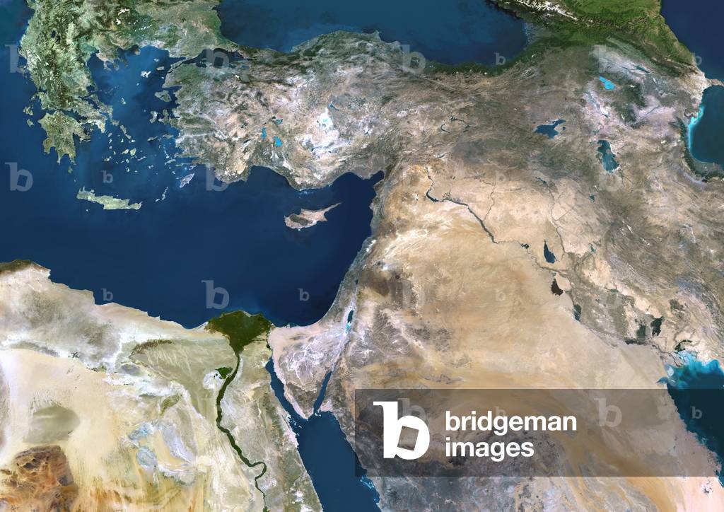
UIG601655 Near East, true colour satellite image. The deserts (light brown) of Saudi Arabia dominate this image. The Persian Gulf (upper right) and the Red Sea (lower centre) border the Arabian Peninsula that has mountains (dark brown) on its western coast. The River Nile (lower center) has a delta on Egypt's Mediterranean Sea coast, south of the island of Cyprus. Israel's coast (green) is below and right of Cyprus. Across top, mountains make up Iran (right) and Turkey (left). A green area (upper centre) lies in Iraq. This image was compiled from data acquired by LANDSAT 5 & 7 satellites.
DC
UIG601983 Piton de la Fournaise, Reunion island, French overseas, true colour satellite image. Piton de la Fournaise (2631m), one of the world's most active volcanoes, is located on the South East part of Reunion Island, in the Indian Ocean. Image taken on 19 June 2000 using LANDSAT data. Print size 30 x 30 cm.
DC
UIG521731 Satellite view of Guinea (with border). Sierra Leone and Liberia are South. This image was compiled from data acquired by LANDSAT 5 & 7 satellites.
DC
UIG601888 True colour satellite image of Erg Iguidi, a sand desert between Algeria and Mauritania. The 250m wide dunes lay in the South on a sand plain, and in the North on a blakek sandstone area. The light blue areas are calcareous and salt crusts left out from the evaporation of the oueds' water. Image taken on 29 March 1987 using LANDSAT data.
DC
PIX4658491 Canary Islands - Canary Islands: Canary Islands viewed by Terra satellite on 21 December 2011 - The Canary Islands are a group of seven large islands and several smaller islets, all volcanic in origin. The eastern edge of the chain lies only 100 kilometers from the coasts of Morocco and Western Sahara, and the chain stretches for about 500 kilometers across the Atlantic. All the islands are mountainous, and Tenerife, the central island in this image is home to Pico del Teide, the highest peak, which rises 12,198 feet (3,718 meters) above sea level - From east to west, the islands are named Lanzarote, Fuerteventura, Gran Canaria, Tenerife, La Gomera, La Palmera and El Hierro. A bright swirl of peacock blue marks the ocean south of El Hierro, a stain on the sea from an ongoing eruption of a volcano under the waters
DC
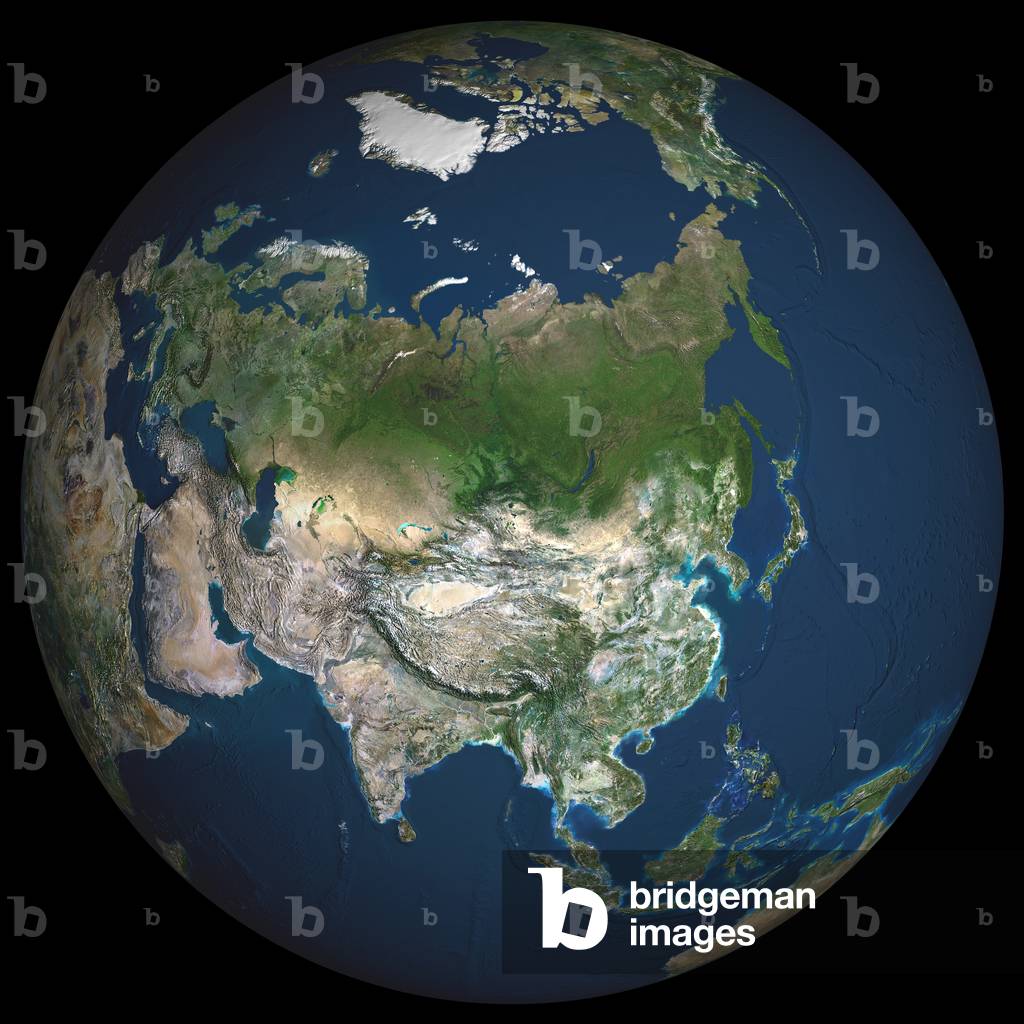
UIG601613 Asia. True colour satellite image centred on Asia, with nearly all of Africa (down left) and Europe (upper left) seen. This image shows the curvature of the Earth, with north-south lines converging towards top. The terrain of Asia varies from deserts (brown, central and southern Asia), to tropical rainforests (dark green, South-East Asia and the Malay Archipelago), to grasslands, forests and tundra (lighter green, northern Asia), and mountain ranges (centre). Also seen is the Arctic (top), Alaska (top right), and the Pacific Ocean (right) and Indian Ocean (lower left). The image used data from LANDSAT 5 & 7 satellites.
DC
PIX4665868 Detroit of Gibraltar seen by satellite - Strait of Gibraltar seen from space - The Detroit of Gibraltar seen by the Terra satellite with the ASTER instrument on 5 July 2000. The visible and infrared image covers an area of 34 km by 59 km. To the north, Spain and the rock of Gibraltar at the end of the tip, to the south, Morocco. The Strait of Gibraltar separates Spain from Morocco. This image, acquired on July 5, 2000, covers an area 34 kilometers (21 miles) wide and 59 kilometers (37 miles) long in three bands of the reflected visible and infrared wavelength region. The promontory on the eastern side of the conspicuous Spanish port is the Rock of Gibraltar. Once one of the two classical Pillars of Hercules, the Rock was crowned with silver columns by Phoenician mariners to mark the limits of safe navigation for the ancient Mediterranean peoples. The rocky promontory still commands the western entrance to the Mediterranean Sea. The rocky limestone and shale ridge rises abruptly from the sea, to a maximum elevation of 426 meters (1,398 feet). A British colony, Gibraltar occupies a narrow strip of land at the southernmost tip of the Iberian Peninsula. It is separated from the Spanish mainland by a neutral zone contained on a narrow, sandy isthmus. Because of its strategic location and formidable topography, Gibraltar serves mainly as a British fortress. Most of its sparse land is taken up by air and naval installations, and the civilian population is small
DC
UIG528827
DC
PIX4665861 Strait of Gibraltar seen from space - The Detroit of Gibraltar seen by the Envisat satellite with the ASAR instrument on 20 May 2002. To the north, Spain and the rock of Gibraltar, to the south, Morocco. Envisat's Advanced Synthetic Aperture Radar (ASAR), a successor to the SAR flown on ESA's European Remote Sensing satellites (ERS)
DC
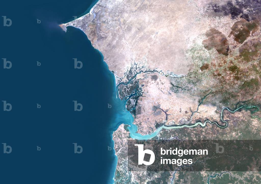
UIG521257 True colour satellite image of the Saloum Delta in Senegal and the Gambia River in Gambia. The Saloum Delta is protected as Saloum Delta National Park. The river basin lies within the Kingdom of Saloum. North of Saloum Delta is Dakar, the capital city of Senegal, located on the Cape Verde Peninsula on the Atlantic coast. South is the Gambia river which runs westward to the Atlantic Ocean at the city of Banjul. Composite image using LANDSAT 5 data.
DC
UIG2614688 Colour satellite image of Pretoria, South Africa. Image taken on August 28, 2014 with Landsat 8 data.
DC
UIG2614687 Colour satellite image of Johannesburg, South Africa. Image taken on August 28, 2014 with Landsat 8 data.
DC
PIX4674091 Cyclones on the South Atlantic - Cyclonic clouds - Two mutually feeding cyclones seen over the cold waters of the South Atlantic Ocean by the Terra satellite on 29 April 2009. North is left. It took the Moderate Resolution Imaging Spectroradiometer (MODIS) on Nasa's Terra satellite a full five minutes to fly over this expansive cloud pattern on April 29, 2009. The sprawling S”” - shaped swirl is actually two cyclones that seem to be feeding on each other. Polar cyclones often form as a result of low - pressure systems over the ocean, and usually bring winds and heavy snow. MODIS acquired this photo - like image over the cold waters of the South Atlantic Ocean, where winter is approaching. The image has been rotated, so that north is toward the left. The spot of green in the upper left corner of the image is coastal water off the southern tip of Africa.
DC
UIG601945 Sand tempest off Morocco and Mauritania, true colour satellite image. The Canaries Islands are on the North part of the image, and Cape Verde Islands on the South part. Image taken on 2 March 2003 using LANDSAT data.
DC
UIG2614686 Colour satellite image of Cape Town, South Africa. Image taken on August 31, 2014 with Landsat 8 data.
DC
PIX4659245 Kalahari Desert - South Africa - 10/1984 - The Kalahari Desert seen by the shuttle STS41G in October 1984
DC
PIX4659389 The Kilimanjaro seen by Landsat 7 02/2000 - The Kilimanjaro, to the right of the image, partly surrounds Kenya and Tanzania, Africa. The plains of Amboseli National Park to the north and Arusha National Park to the south and west are visible.
DC
UIG2614691 Colour satellite image of Juba, South Sudan. Image taken on August 26, 2014 with Landsat 8 data.
DC
PIX4658479 Jwaneng Diamond Mine - Botswana - Jwaneng diamond mine - Botswana: The Jwaneng Mine is an open pit diamond mine located in Botswana. Production began in 1982 and is described as the largest diamond mine in the world. Image taken from the International Space Station (ISS) on 30 June 2003. The Jwaneng diamond mine is the richest diamond mine in the world and is located in south-central Botswana. Astronaut photograph was acquired on June 30, 2003 from the International Space Station (ISS)
DC
UIG601603 Earth. True colour satellite image of the Earth, centred on Asia. The North Pole is at upper centre. Water is blue, vegetation is green, arid areas are brown, and snow and ice are white. Both land and ocean floor topography are shown. The terrain of Asia varies from deserts (brown, central and southern Asia), to tropical rainforests (dark green, South- East Asia), to plains, forests and tundra (lighter green, northern Asia), and mountain ranges (lower centre). Surrounding mainland Asia (clockwise from top) is the Arctic Ocean (with Greenland and North America beyond), the Pacific Ocean, the Malay Archipelago and northern Australia, the Indian Ocean, north-eastern Africa, and Europe. The picture is a composite created from thousands of separate images recorded by LANDSAT 5 & 7 satellites. Print size 42x42cm.
DC
UIG521729 Relief map of Guinea (with border). Sierra Leone and Liberia are South. This image was compiled from data acquired by LANDSAT 5 & 7 satellites combined with elevation data.
DC

Total de Resultados: 111

Página 1 de 2