 imprimir
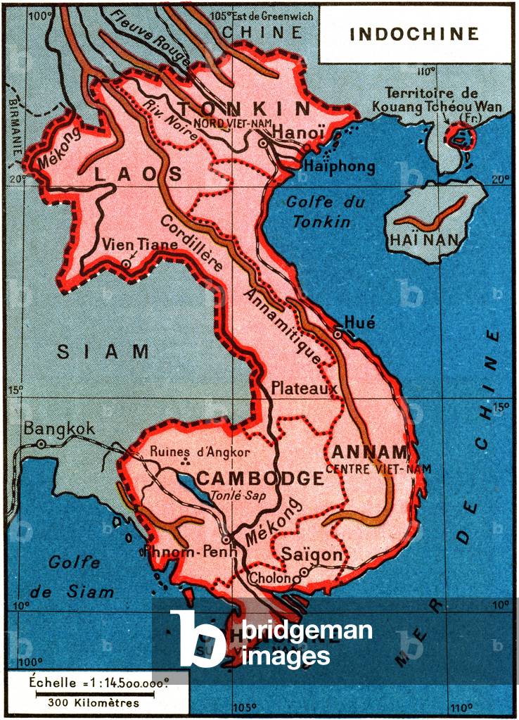
Map of French colonial Indochina in the middle of the twentieth century - Cochinchine, Cambodia, ...
|
Código da imagem : PCT4286316 Dimensões : 2.553 X 3.539 pixels Orientação : vertical |
Data da foto:
25/05/2025 Tamanho máximo não comprimido : 25,8MB |
| Pauta: | Map of French colonial Indochina in the middle of the twentieth century - Cochinchine, Cambodia, Annam, Laos and Tonkin, borders on one side by China and on the other by Siam and Burma - Asia, colonies, colonial empire - counter, protectorate - Vietnam (Viet Nam, South Vietnam, Central and North) - extract from a 1951 Belin geography book - |
| Título: | Map of French colonial Indochina in the middle of the twentieth century - Cochinchine, Cambodia, Annam, Laos and Tonkin, borders on one side by China and on the other by Siam and Burma - Asia, colonies, colonial empire - counter, protectorate - Vietnam (Viet Nam, South Vietnam, Central and North) - extract from a 1951 Belin geography book - |
| Descrição: | Map of French colonial Indochina in the middle of the twentieth century - Cochinchine, Cambodia, Annam, Laos and Tonkin, borders on one side by China and on the other by Siam and Burma - Asia, colonies, colonial empire - counter, protectorate - Vietnam (Viet Nam, South Vietnam, Central and North) - extract from a 1951 Belin geography book - Veja a descrição original em inglês |
| Coleção: | Bridgeman |
| Crédito: | Bridgeman Images / Fotoarena |
| Disponibilidade: | sob-consulta |
| Direito de uso: | Direito controlado |
| Autorização do(a) modelo: | não |
| Autorização da propriedade: | não |
Esta imagem pode conter outros direitos. Cabe a quem usa, verificar e licenciar.
COPYRIGHT 2008-2025 FOTOARENA. PROIBIDA A CÓPIA OU REPRODUÇÃO SEM AUTORIZAÇÃO PRÉVIA.