
























































alb31117800
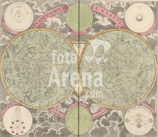
Planisphaerium caeleste secundum restitutionem Hevellanam, Celestial map with the northern and southern constellations, print, Celestial map with the northern and southern constellations. Above, from left to right, views of the Tycho Brahe system, the Ptolemaic system, and the effect of the moon on the tides. Below, depictions of the phases of the moon, the system of Nicolaus Copernicus, and the position of the Earth while orbiting the sun, according to Philippus Lansbergen., after design by Georg Christoph Eimmart (II), publisher: Johann Baptista Homann, Nuremberg, 1707, printmaker, Bavaria, paper, engraving, etching, hand coloring, etching and engraving, hand-colored, height 491 mm x width 567 mm, full moon, sun as celestial body, zodiac, the twelve zodiacal signs together, solar eclipse, star-chart, star map., A colored engraving showing two large circular star maps side by side with faint green backgrounds, detailed constellation illustrations and many small golden star markers, each map bordered by a thin yellow rim and intersected by radial lines; above them a pink ribbon arc with large capital letters stretches between a pale green circular diagram with concentric rings and two smaller circular diagrams on either side set against a cloudy sky background; below the maps additional circular diagrams and a pink ribbon with decorative scrolls appear among engraved clouds, and a narrow vertical seam runs down the center of the image.
DC